You are here: Home > Network List > TA - USArray Transportable Network (new EarthScope stations) Stations List
> Station O03E Paynes Creek, CA, USA > Earthquake Result Viewer
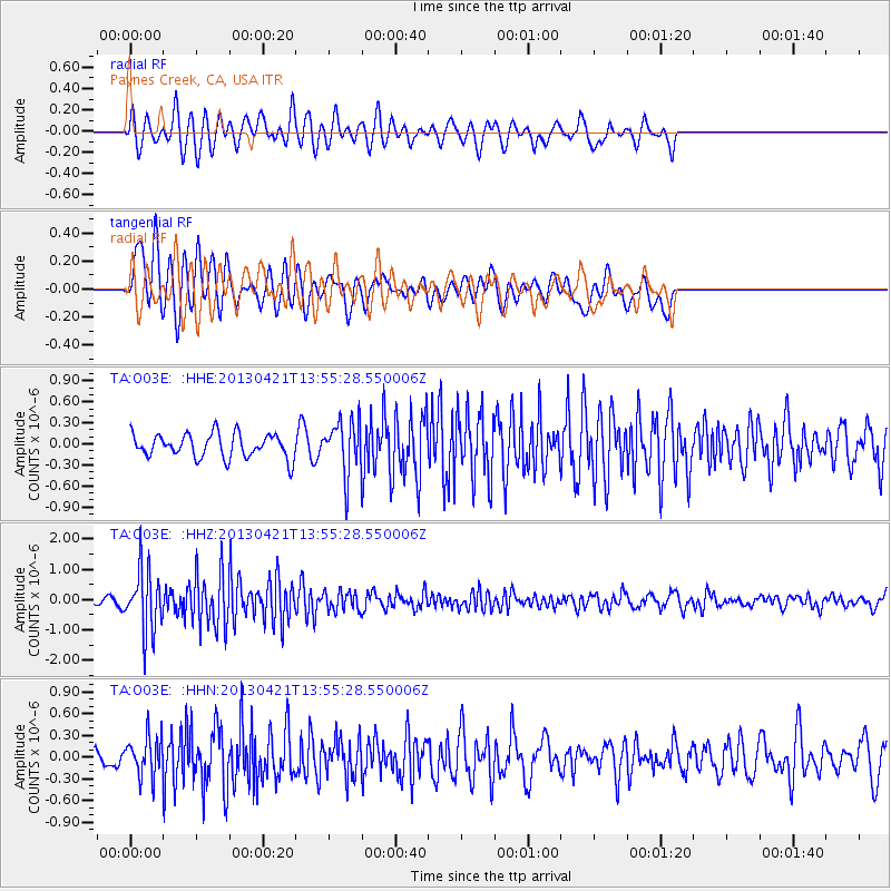
O03E Paynes Creek, CA, USA - Earthquake Result Viewer
*The percent match for this event was below the threshold and hence no stack was calculated.
| Earthquake location: |
Andreanof Islands, Aleutian Is. |
| Earthquake latitude/longitude: |
51.7/-178.2 |
| Earthquake time(UTC): |
2013/04/21 (111) 13:48:29 GMT |
| Earthquake Depth: |
44 km |
| Earthquake Magnitude: |
5.6 MW, 5.7 MW, 5.9 MB |
| Earthquake Catalog/Contributor: |
NEIC PDE/NEIC PDE-W |
|
| Network: |
TA USArray Transportable Network (new EarthScope stations) |
| Station: |
O03E Paynes Creek, CA, USA |
| Lat/Lon: |
40.29 N/121.80 W |
| Elevation: |
967 m |
|
| Distance: |
39.9 deg |
| Az: |
83.696 deg |
| Baz: |
305.963 deg |
| Ray Param: |
$rayparam |
*The percent match for this event was below the threshold and hence was not used in the summary stack. |
|
| Radial Match: |
64.01059 % |
| Radial Bump: |
400 |
| Transverse Match: |
55.7446 % |
| Transverse Bump: |
400 |
| SOD ConfigId: |
512894 |
| Insert Time: |
2013-09-13 17:28:12.483 +0000 |
| GWidth: |
2.5 |
| Max Bumps: |
400 |
| Tol: |
0.001 |
|
Signal To Noise
| Channel | StoN | STA | LTA |
| TA:O03E: :HHZ:20130421T13:55:28.550006Z | 6.3033013 | 1.0192099E-6 | 1.6169462E-7 |
| TA:O03E: :HHN:20130421T13:55:28.550006Z | 2.0422182 | 2.6969568E-7 | 1.3206018E-7 |
| TA:O03E: :HHE:20130421T13:55:28.550006Z | 2.1677172 | 3.6996877E-7 | 1.7067207E-7 |
| Arrivals |
| Ps | |
| PpPs | |
| PsPs/PpSs | |


