You are here: Home > Network List > TA - USArray Transportable Network (new EarthScope stations) Stations List
> Station O45A Potomac, IL, USA > Earthquake Result Viewer
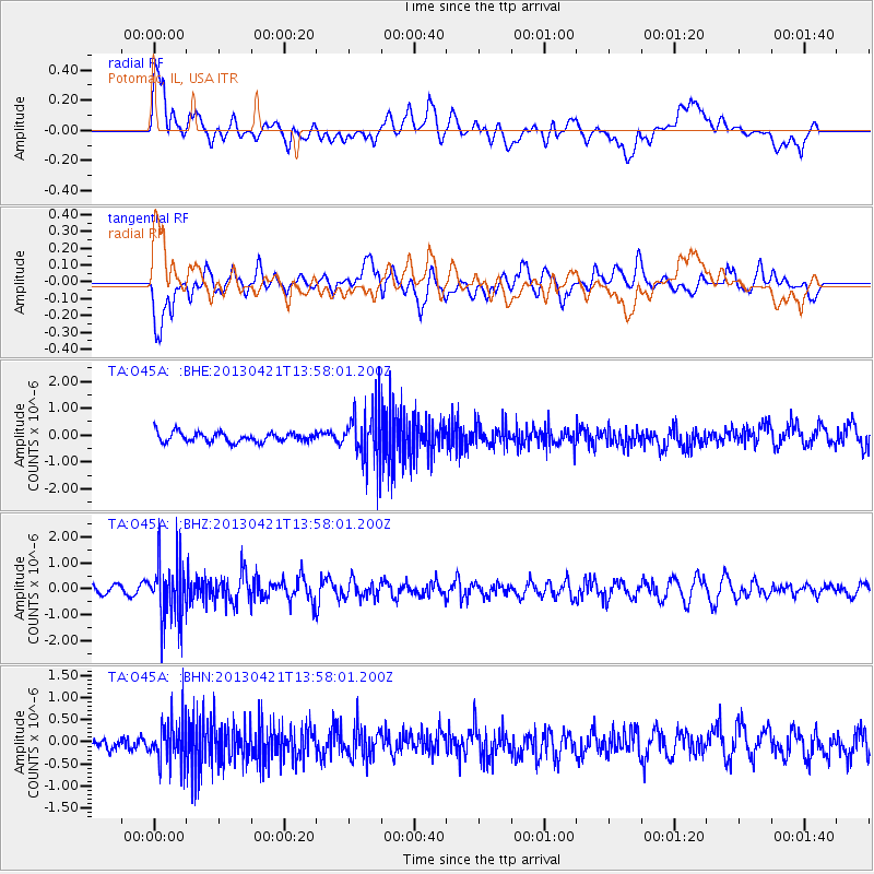
O45A Potomac, IL, USA - Earthquake Result Viewer
*The percent match for this event was below the threshold and hence no stack was calculated.
| Earthquake location: |
Andreanof Islands, Aleutian Is. |
| Earthquake latitude/longitude: |
51.7/-178.2 |
| Earthquake time(UTC): |
2013/04/21 (111) 13:48:29 GMT |
| Earthquake Depth: |
44 km |
| Earthquake Magnitude: |
5.6 MW, 5.7 MW, 5.9 MB |
| Earthquake Catalog/Contributor: |
NEIC PDE/NEIC PDE-W |
|
| Network: |
TA USArray Transportable Network (new EarthScope stations) |
| Station: |
O45A Potomac, IL, USA |
| Lat/Lon: |
40.25 N/87.72 W |
| Elevation: |
208 m |
|
| Distance: |
60.1 deg |
| Az: |
62.042 deg |
| Baz: |
314.045 deg |
| Ray Param: |
$rayparam |
*The percent match for this event was below the threshold and hence was not used in the summary stack. |
|
| Radial Match: |
57.585014 % |
| Radial Bump: |
400 |
| Transverse Match: |
66.42849 % |
| Transverse Bump: |
400 |
| SOD ConfigId: |
512894 |
| Insert Time: |
2013-09-13 17:28:29.106 +0000 |
| GWidth: |
2.5 |
| Max Bumps: |
400 |
| Tol: |
0.001 |
|
Signal To Noise
| Channel | StoN | STA | LTA |
| TA:O45A: :BHZ:20130421T13:58:01.200Z | 8.886632 | 1.2029763E-6 | 1.353692E-7 |
| TA:O45A: :BHN:20130421T13:58:01.200Z | 3.0940156 | 4.8718056E-7 | 1.5745898E-7 |
| TA:O45A: :BHE:20130421T13:58:01.200Z | 5.6475024 | 9.932012E-7 | 1.7586555E-7 |
| Arrivals |
| Ps | |
| PpPs | |
| PsPs/PpSs | |


