You are here: Home > Network List > TA - USArray Transportable Network (new EarthScope stations) Stations List
> Station Q48A North Vernon, IN, USA > Earthquake Result Viewer
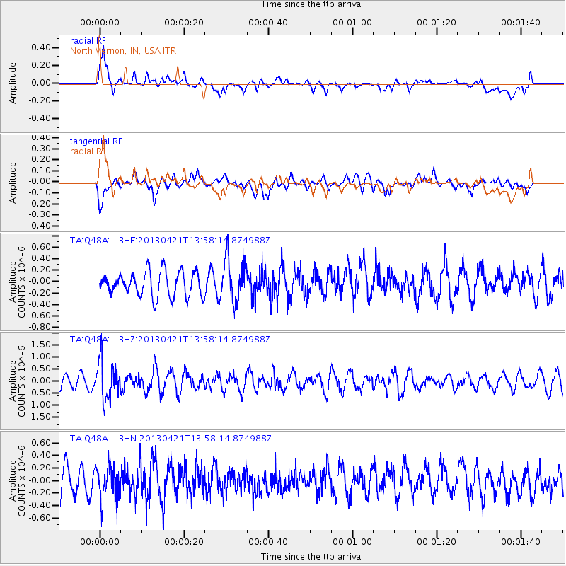
Q48A North Vernon, IN, USA - Earthquake Result Viewer
*The percent match for this event was below the threshold and hence no stack was calculated.
| Earthquake location: |
Andreanof Islands, Aleutian Is. |
| Earthquake latitude/longitude: |
51.7/-178.2 |
| Earthquake time(UTC): |
2013/04/21 (111) 13:48:29 GMT |
| Earthquake Depth: |
44 km |
| Earthquake Magnitude: |
5.6 MW, 5.7 MW, 5.9 MB |
| Earthquake Catalog/Contributor: |
NEIC PDE/NEIC PDE-W |
|
| Network: |
TA USArray Transportable Network (new EarthScope stations) |
| Station: |
Q48A North Vernon, IN, USA |
| Lat/Lon: |
38.93 N/85.73 W |
| Elevation: |
185 m |
|
| Distance: |
62.1 deg |
| Az: |
61.876 deg |
| Baz: |
315.23 deg |
| Ray Param: |
$rayparam |
*The percent match for this event was below the threshold and hence was not used in the summary stack. |
|
| Radial Match: |
69.17572 % |
| Radial Bump: |
400 |
| Transverse Match: |
51.06238 % |
| Transverse Bump: |
400 |
| SOD ConfigId: |
512894 |
| Insert Time: |
2013-09-13 17:29:50.393 +0000 |
| GWidth: |
2.5 |
| Max Bumps: |
400 |
| Tol: |
0.001 |
|
Signal To Noise
| Channel | StoN | STA | LTA |
| TA:Q48A: :BHZ:20130421T13:58:14.874988Z | 3.377258 | 7.9742887E-7 | 2.3611726E-7 |
| TA:Q48A: :BHN:20130421T13:58:14.874988Z | 1.1752514 | 2.6732187E-7 | 2.2745931E-7 |
| TA:Q48A: :BHE:20130421T13:58:14.874988Z | 1.7603809 | 3.7400986E-7 | 2.1245964E-7 |
| Arrivals |
| Ps | |
| PpPs | |
| PsPs/PpSs | |


