You are here: Home > Network List > TJ - Tajikistan National Seismic Network Stations List
> Station GARM Garm, Tajikistan > Earthquake Result Viewer
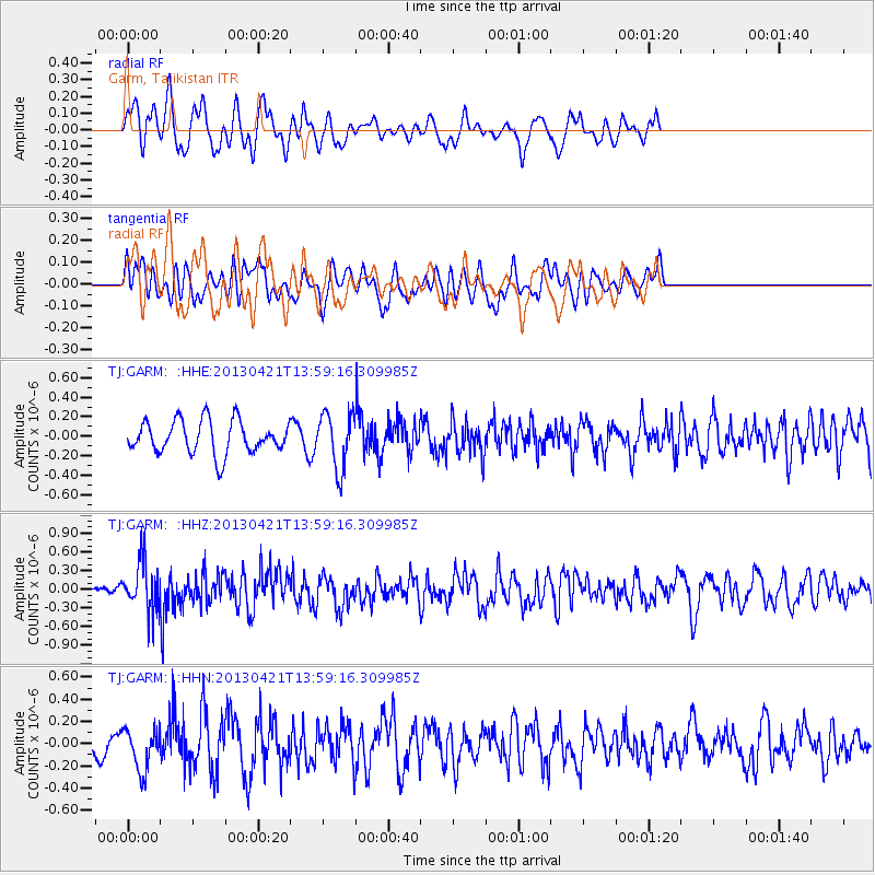
GARM Garm, Tajikistan - Earthquake Result Viewer
*The percent match for this event was below the threshold and hence no stack was calculated.
| Earthquake location: |
Andreanof Islands, Aleutian Is. |
| Earthquake latitude/longitude: |
51.7/-178.2 |
| Earthquake time(UTC): |
2013/04/21 (111) 13:48:29 GMT |
| Earthquake Depth: |
44 km |
| Earthquake Magnitude: |
5.6 MW, 5.7 MW, 5.9 MB |
| Earthquake Catalog/Contributor: |
NEIC PDE/NEIC PDE-W |
|
| Network: |
TJ Tajikistan National Seismic Network |
| Station: |
GARM Garm, Tajikistan |
| Lat/Lon: |
39.00 N/70.32 E |
| Elevation: |
1305 m |
|
| Distance: |
71.8 deg |
| Az: |
310.217 deg |
| Baz: |
37.617 deg |
| Ray Param: |
$rayparam |
*The percent match for this event was below the threshold and hence was not used in the summary stack. |
|
| Radial Match: |
53.55176 % |
| Radial Bump: |
363 |
| Transverse Match: |
44.0606 % |
| Transverse Bump: |
400 |
| SOD ConfigId: |
512894 |
| Insert Time: |
2013-09-13 17:36:48.557 +0000 |
| GWidth: |
2.5 |
| Max Bumps: |
400 |
| Tol: |
0.001 |
|
Signal To Noise
| Channel | StoN | STA | LTA |
| TJ:GARM: :HHZ:20130421T13:59:16.309985Z | 3.6406698 | 3.9264012E-7 | 1.0784832E-7 |
| TJ:GARM: :HHN:20130421T13:59:16.309985Z | 1.4751319 | 1.8634404E-7 | 1.2632364E-7 |
| TJ:GARM: :HHE:20130421T13:59:16.309985Z | 1.7057987 | 2.8529655E-7 | 1.67251E-7 |
| Arrivals |
| Ps | |
| PpPs | |
| PsPs/PpSs | |


