You are here: Home > Network List > US - United States National Seismic Network Stations List
> Station NEW Newport, Washington, USA > Earthquake Result Viewer
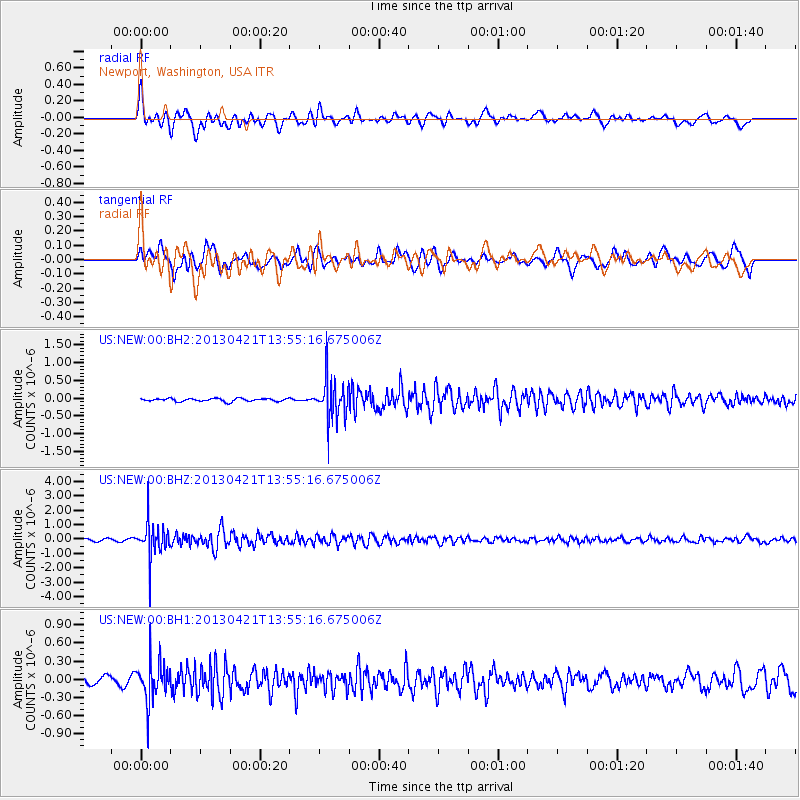
NEW Newport, Washington, USA - Earthquake Result Viewer
*The percent match for this event was below the threshold and hence no stack was calculated.
| Earthquake location: |
Andreanof Islands, Aleutian Is. |
| Earthquake latitude/longitude: |
51.7/-178.2 |
| Earthquake time(UTC): |
2013/04/21 (111) 13:48:29 GMT |
| Earthquake Depth: |
44 km |
| Earthquake Magnitude: |
5.6 MW, 5.7 MW, 5.9 MB |
| Earthquake Catalog/Contributor: |
NEIC PDE/NEIC PDE-W |
|
| Network: |
US United States National Seismic Network |
| Station: |
NEW Newport, Washington, USA |
| Lat/Lon: |
48.26 N/117.12 W |
| Elevation: |
760 m |
|
| Distance: |
38.5 deg |
| Az: |
70.178 deg |
| Baz: |
298.729 deg |
| Ray Param: |
$rayparam |
*The percent match for this event was below the threshold and hence was not used in the summary stack. |
|
| Radial Match: |
73.900536 % |
| Radial Bump: |
400 |
| Transverse Match: |
61.241234 % |
| Transverse Bump: |
400 |
| SOD ConfigId: |
512894 |
| Insert Time: |
2013-09-13 17:39:00.432 +0000 |
| GWidth: |
2.5 |
| Max Bumps: |
400 |
| Tol: |
0.001 |
|
Signal To Noise
| Channel | StoN | STA | LTA |
| US:NEW:00:BHZ:20130421T13:55:16.675006Z | 16.403322 | 1.2274859E-6 | 7.483154E-8 |
| US:NEW:00:BH1:20130421T13:55:16.675006Z | 5.101414 | 3.2459684E-7 | 6.36288E-8 |
| US:NEW:00:BH2:20130421T13:55:16.675006Z | 13.557433 | 5.678875E-7 | 4.188754E-8 |
| Arrivals |
| Ps | |
| PpPs | |
| PsPs/PpSs | |


