You are here: Home > Network List > US - United States National Seismic Network Stations List
> Station VBMS Vicksburg, Mississippi > Earthquake Result Viewer
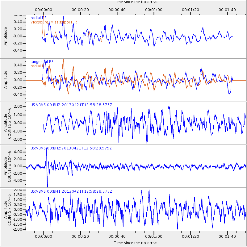
VBMS Vicksburg, Mississippi - Earthquake Result Viewer
*The percent match for this event was below the threshold and hence no stack was calculated.
| Earthquake location: |
Andreanof Islands, Aleutian Is. |
| Earthquake latitude/longitude: |
51.7/-178.2 |
| Earthquake time(UTC): |
2013/04/21 (111) 13:48:29 GMT |
| Earthquake Depth: |
44 km |
| Earthquake Magnitude: |
5.6 MW, 5.7 MW, 5.9 MB |
| Earthquake Catalog/Contributor: |
NEIC PDE/NEIC PDE-W |
|
| Network: |
US United States National Seismic Network |
| Station: |
VBMS Vicksburg, Mississippi |
| Lat/Lon: |
32.22 N/90.52 W |
| Elevation: |
0.0 m |
|
| Distance: |
64.1 deg |
| Az: |
70.249 deg |
| Baz: |
316.245 deg |
| Ray Param: |
$rayparam |
*The percent match for this event was below the threshold and hence was not used in the summary stack. |
|
| Radial Match: |
58.578457 % |
| Radial Bump: |
400 |
| Transverse Match: |
47.41633 % |
| Transverse Bump: |
400 |
| SOD ConfigId: |
512894 |
| Insert Time: |
2013-09-13 17:39:24.516 +0000 |
| GWidth: |
2.5 |
| Max Bumps: |
400 |
| Tol: |
0.001 |
|
Signal To Noise
| Channel | StoN | STA | LTA |
| US:VBMS:00:BHZ:20130421T13:58:28.575Z | 6.906565 | 1.9447589E-6 | 2.815812E-7 |
| US:VBMS:00:BH1:20130421T13:58:28.575Z | 1.0900633 | 6.859056E-7 | 6.292346E-7 |
| US:VBMS:00:BH2:20130421T13:58:28.575Z | 1.3460934 | 8.581597E-7 | 6.3751867E-7 |
| Arrivals |
| Ps | |
| PpPs | |
| PsPs/PpSs | |


