You are here: Home > Network List > G - GEOSCOPE Stations List
> Station TAOE Taiohae, Marquises islands > Earthquake Result Viewer
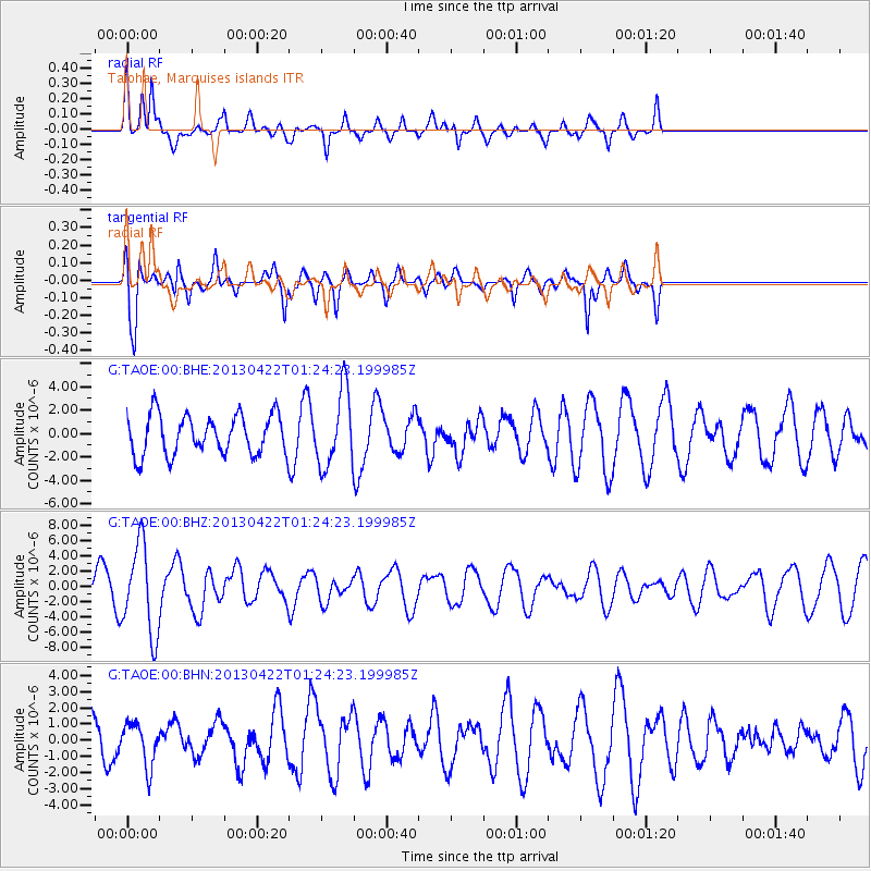
TAOE Taiohae, Marquises islands - Earthquake Result Viewer
*The percent match for this event was below the threshold and hence no stack was calculated.
| Earthquake location: |
Michoacan, Mexico |
| Earthquake latitude/longitude: |
18.1/-102.2 |
| Earthquake time(UTC): |
2013/04/22 (112) 01:16:32 GMT |
| Earthquake Depth: |
30 km |
| Earthquake Magnitude: |
6.0 MW, 5.6 MB, 5.9 MS, 5.9 MW |
| Earthquake Catalog/Contributor: |
NEIC PDE/NEIC PDE-W |
|
| Network: |
G GEOSCOPE |
| Station: |
TAOE Taiohae, Marquises islands |
| Lat/Lon: |
8.85 S/140.15 W |
| Elevation: |
800 m |
|
| Distance: |
46.1 deg |
| Az: |
237.601 deg |
| Baz: |
54.362 deg |
| Ray Param: |
$rayparam |
*The percent match for this event was below the threshold and hence was not used in the summary stack. |
|
| Radial Match: |
52.399677 % |
| Radial Bump: |
307 |
| Transverse Match: |
68.950584 % |
| Transverse Bump: |
400 |
| SOD ConfigId: |
512894 |
| Insert Time: |
2013-09-13 17:52:24.658 +0000 |
| GWidth: |
2.5 |
| Max Bumps: |
400 |
| Tol: |
0.001 |
|
Signal To Noise
| Channel | StoN | STA | LTA |
| G:TAOE:00:BHZ:20130422T01:24:23.199985Z | 2.98607 | 5.8086684E-6 | 1.9452555E-6 |
| G:TAOE:00:BHN:20130422T01:24:23.199985Z | 0.6971403 | 1.3108196E-6 | 1.880281E-6 |
| G:TAOE:00:BHE:20130422T01:24:23.199985Z | 1.8948019 | 3.2066514E-6 | 1.6923412E-6 |
| Arrivals |
| Ps | |
| PpPs | |
| PsPs/PpSs | |


