You are here: Home > Network List > AV - Alaska Volcano Observatory Stations List
> Station MAPS Pakushin Southeast, Makushin Volcano, Alaska > Earthquake Result Viewer
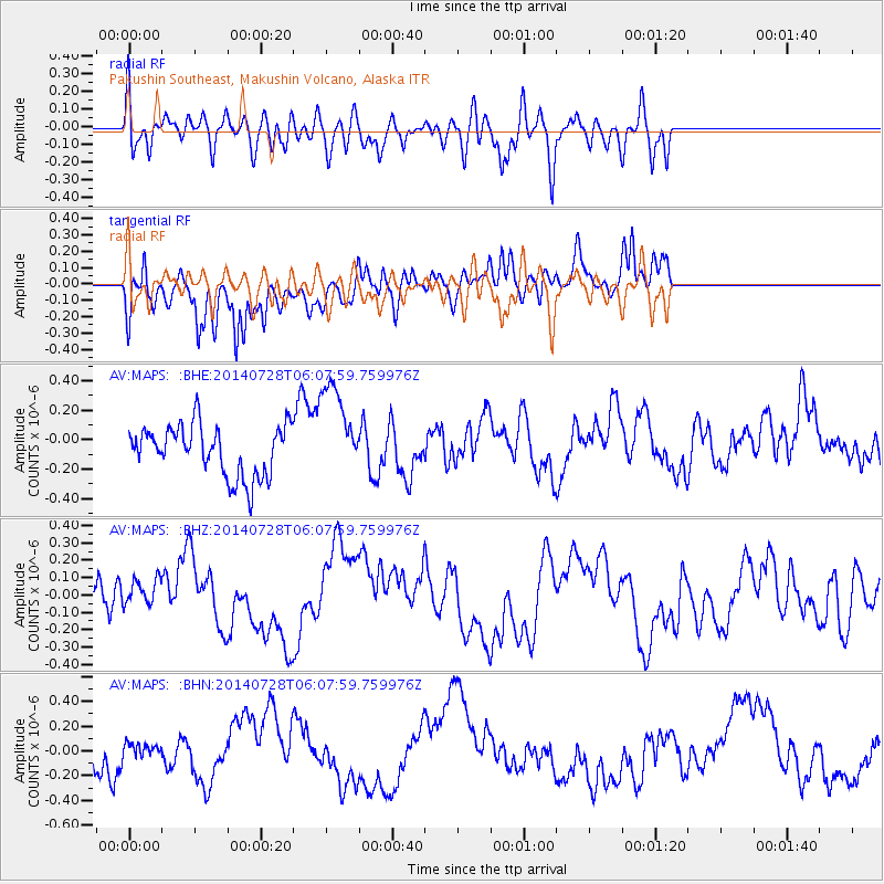
MAPS Pakushin Southeast, Makushin Volcano, Alaska - Earthquake Result Viewer
*The percent match for this event was below the threshold and hence no stack was calculated.
| Earthquake location: |
South Of Java, Indonesia |
| Earthquake latitude/longitude: |
-8.1/106.4 |
| Earthquake time(UTC): |
2014/07/28 (209) 05:55:15 GMT |
| Earthquake Depth: |
42 km |
| Earthquake Magnitude: |
4.3 mb |
| Earthquake Catalog/Contributor: |
ISC/ISC |
|
| Network: |
AV Alaska Volcano Observatory |
| Station: |
MAPS Pakushin Southeast, Makushin Volcano, Alaska |
| Lat/Lon: |
53.81 N/166.94 W |
| Elevation: |
333 m |
|
| Distance: |
94.5 deg |
| Az: |
36.437 deg |
| Baz: |
262.568 deg |
| Ray Param: |
$rayparam |
*The percent match for this event was below the threshold and hence was not used in the summary stack. |
|
| Radial Match: |
23.823679 % |
| Radial Bump: |
400 |
| Transverse Match: |
50.833736 % |
| Transverse Bump: |
365 |
| SOD ConfigId: |
3390531 |
| Insert Time: |
2019-04-13 01:40:14.295 +0000 |
| GWidth: |
2.5 |
| Max Bumps: |
400 |
| Tol: |
0.001 |
|
Signal To Noise
| Channel | StoN | STA | LTA |
| AV:MAPS: :BHZ:20140728T06:07:59.759976Z | 0.7972718 | 9.296154E-8 | 1.1659957E-7 |
| AV:MAPS: :BHN:20140728T06:07:59.759976Z | 0.2416399 | 7.050637E-8 | 2.917828E-7 |
| AV:MAPS: :BHE:20140728T06:07:59.759976Z | 1.9416614 | 3.3243194E-7 | 1.7121005E-7 |
| Arrivals |
| Ps | |
| PpPs | |
| PsPs/PpSs | |


