PSI Parapat, Indonesia - Earthquake Result Viewer
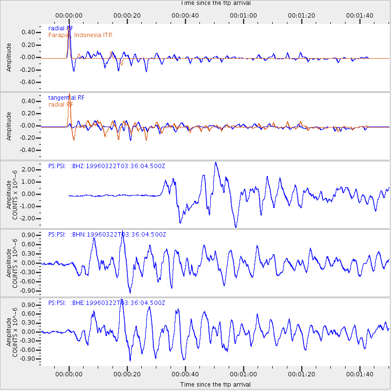
Earthquake location: Rat Islands, Aleutian Islands
Earthquake latitude/longitude: 51.2/178.7
Earthquake time(UTC): 1996/03/22 (082) 03:24:20 GMT
Earthquake Depth: 20 km
Earthquake Magnitude: 5.7 MB, 6.6 MS, 6.8 UNKNOWN, 6.6 ML
Earthquake Catalog/Contributor: WHDF/NEIC
Network: PS Pacific21
Station: PSI Parapat, Indonesia
Lat/Lon: 2.69 N/98.92 E
Elevation: 987 m
Distance: 81.5 deg
Az: 263.698 deg
Baz: 38.738 deg
Ray Param: 0.047526475
Estimated Moho Depth: 45.5 km
Estimated Crust Vp/Vs: 1.92
Assumed Crust Vp: 6.468 km/s
Estimated Crust Vs: 3.36 km/s
Estimated Crust Poisson's Ratio: 0.32
Radial Match: 97.089455 %
Radial Bump: 357
Transverse Match: 85.06365 %
Transverse Bump: 400
SOD ConfigId: 6273
Insert Time: 2010-02-27 03:19:01.933 +0000
GWidth: 2.5
Max Bumps: 400
Tol: 0.001

Signal To Noise

ChannelStoNSTALTA
PS:PSI: :BHN:19960322T03:36:04.500Z8.8022251.7936243E-72.0376943E-8
PS:PSI: :BHE:19960322T03:36:04.500Z3.68369051.3727588E-73.7265856E-8
PS:PSI: :BHZ:19960322T03:36:04.500Z14.7202555.4637906E-73.7117502E-8
Arrivals
Ps6.7 SECOND
PpPs20 SECOND
PsPs/PpSs27 SECOND