
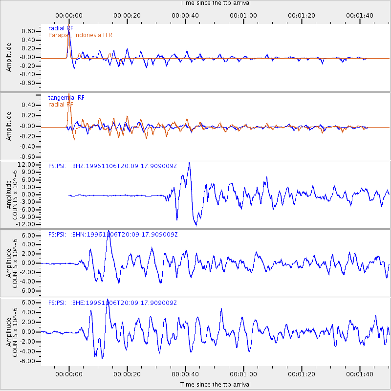
PSI Parapat, Indonesia - Earthquake Result Viewer
| ||||||||||||||||||
| ||||||||||||||||||
| ||||||||||||||||||
|
Signal To Noise
| Channel | StoN | STA | LTA |
| PS:PSI: :BHN:19961106T20:09:17.909009Z | 1.8133847 | 2.2307884E-7 | 1.2301794E-7 |
| PS:PSI: :BHE:19961106T20:09:17.909009Z | 2.816728 | 3.8180139E-7 | 1.3554784E-7 |
| PS:PSI: :BHZ:19961106T20:09:17.909009Z | 5.203817 | 6.987056E-7 | 1.342679E-7 |
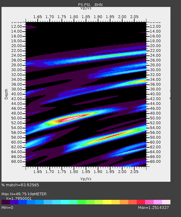
| Arrivals | |
| Ps | 6.5 SECOND |
| PpPs | 20 SECOND |
| PsPs/PpSs | 27 SECOND |

