You are here: Home > Network List > TA - USArray Transportable Network (new EarthScope stations) Stations List
> Station S55A Lewisburg, WV, USA > Earthquake Result Viewer
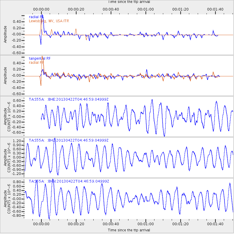
S55A Lewisburg, WV, USA - Earthquake Result Viewer
*The percent match for this event was below the threshold and hence no stack was calculated.
| Earthquake location: |
Rat Islands, Aleutian Islands |
| Earthquake latitude/longitude: |
51.1/179.4 |
| Earthquake time(UTC): |
2013/04/22 (112) 04:36:36 GMT |
| Earthquake Depth: |
18 km |
| Earthquake Magnitude: |
5.6 MW, 5.5 MW |
| Earthquake Catalog/Contributor: |
NEIC PDE/NEIC PDE-W |
|
| Network: |
TA USArray Transportable Network (new EarthScope stations) |
| Station: |
S55A Lewisburg, WV, USA |
| Lat/Lon: |
37.77 N/80.50 W |
| Elevation: |
647 m |
|
| Distance: |
67.3 deg |
| Az: |
57.734 deg |
| Baz: |
317.714 deg |
| Ray Param: |
$rayparam |
*The percent match for this event was below the threshold and hence was not used in the summary stack. |
|
| Radial Match: |
79.73818 % |
| Radial Bump: |
400 |
| Transverse Match: |
55.092354 % |
| Transverse Bump: |
400 |
| SOD ConfigId: |
512894 |
| Insert Time: |
2013-09-13 18:32:29.058 +0000 |
| GWidth: |
2.5 |
| Max Bumps: |
400 |
| Tol: |
0.001 |
|
Signal To Noise
| Channel | StoN | STA | LTA |
| TA:S55A: :BHZ:20130422T04:46:59.04999Z | 1.1460047 | 5.2326135E-7 | 4.565962E-7 |
| TA:S55A: :BHN:20130422T04:46:59.04999Z | 1.7018989 | 5.388536E-7 | 3.1661907E-7 |
| TA:S55A: :BHE:20130422T04:46:59.04999Z | 0.4325191 | 1.0818575E-7 | 2.5012943E-7 |
| Arrivals |
| Ps | |
| PpPs | |
| PsPs/PpSs | |


