You are here: Home > Network List > US - United States National Seismic Network Stations List
> Station CBKS Cedar Bluff, Kansas, USA > Earthquake Result Viewer
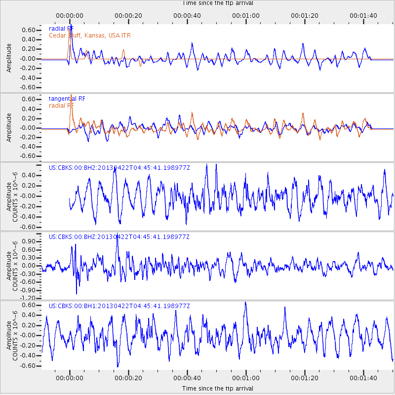
CBKS Cedar Bluff, Kansas, USA - Earthquake Result Viewer
*The percent match for this event was below the threshold and hence no stack was calculated.
| Earthquake location: |
Rat Islands, Aleutian Islands |
| Earthquake latitude/longitude: |
51.1/179.4 |
| Earthquake time(UTC): |
2013/04/22 (112) 04:36:36 GMT |
| Earthquake Depth: |
18 km |
| Earthquake Magnitude: |
5.6 MW, 5.5 MW |
| Earthquake Catalog/Contributor: |
NEIC PDE/NEIC PDE-W |
|
| Network: |
US United States National Seismic Network |
| Station: |
CBKS Cedar Bluff, Kansas, USA |
| Lat/Lon: |
38.81 N/99.74 W |
| Elevation: |
677 m |
|
| Distance: |
55.8 deg |
| Az: |
68.915 deg |
| Baz: |
311.143 deg |
| Ray Param: |
$rayparam |
*The percent match for this event was below the threshold and hence was not used in the summary stack. |
|
| Radial Match: |
59.564224 % |
| Radial Bump: |
400 |
| Transverse Match: |
61.94368 % |
| Transverse Bump: |
400 |
| SOD ConfigId: |
512894 |
| Insert Time: |
2013-09-13 18:35:55.789 +0000 |
| GWidth: |
2.5 |
| Max Bumps: |
400 |
| Tol: |
0.001 |
|
Signal To Noise
| Channel | StoN | STA | LTA |
| US:CBKS:00:BHZ:20130422T04:45:41.198977Z | 2.7002237 | 3.8530032E-7 | 1.42692E-7 |
| US:CBKS:00:BH1:20130422T04:45:41.198977Z | 0.5770655 | 1.6719052E-7 | 2.8972536E-7 |
| US:CBKS:00:BH2:20130422T04:45:41.198977Z | 0.94458115 | 2.2042573E-7 | 2.3335818E-7 |
| Arrivals |
| Ps | |
| PpPs | |
| PsPs/PpSs | |


