You are here: Home > Network List > US - United States National Seismic Network Stations List
> Station AMTX Amarillo, Texas, USA > Earthquake Result Viewer
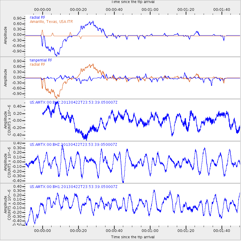
AMTX Amarillo, Texas, USA - Earthquake Result Viewer
*The percent match for this event was below the threshold and hence no stack was calculated.
| Earthquake location: |
Kermadec Islands Region |
| Earthquake latitude/longitude: |
-29.8/-176.2 |
| Earthquake time(UTC): |
2013/04/22 (112) 23:40:47 GMT |
| Earthquake Depth: |
13 km |
| Earthquake Magnitude: |
5.5 MB |
| Earthquake Catalog/Contributor: |
NEIC PDE/NEIC PDE-W |
|
| Network: |
US United States National Seismic Network |
| Station: |
AMTX Amarillo, Texas, USA |
| Lat/Lon: |
34.53 N/101.41 W |
| Elevation: |
1010 m |
|
| Distance: |
95.2 deg |
| Az: |
53.142 deg |
| Baz: |
237.404 deg |
| Ray Param: |
$rayparam |
*The percent match for this event was below the threshold and hence was not used in the summary stack. |
|
| Radial Match: |
42.43101 % |
| Radial Bump: |
400 |
| Transverse Match: |
53.76788 % |
| Transverse Bump: |
400 |
| SOD ConfigId: |
512894 |
| Insert Time: |
2013-09-13 18:56:20.257 +0000 |
| GWidth: |
2.5 |
| Max Bumps: |
400 |
| Tol: |
0.001 |
|
Signal To Noise
| Channel | StoN | STA | LTA |
| US:AMTX:00:BHZ:20130422T23:53:39.050007Z | 1.2755162 | 1.3297974E-7 | 1.0425562E-7 |
| US:AMTX:00:BH1:20130422T23:53:39.050007Z | 0.56816727 | 1.2068496E-7 | 2.1241097E-7 |
| US:AMTX:00:BH2:20130422T23:53:39.050007Z | 0.827366 | 2.3809353E-7 | 2.8777293E-7 |
| Arrivals |
| Ps | |
| PpPs | |
| PsPs/PpSs | |


