
PSI Parapat, Indonesia - Earthquake Result Viewer
| ||||||||||||||||||
| ||||||||||||||||||
| ||||||||||||||||||
|
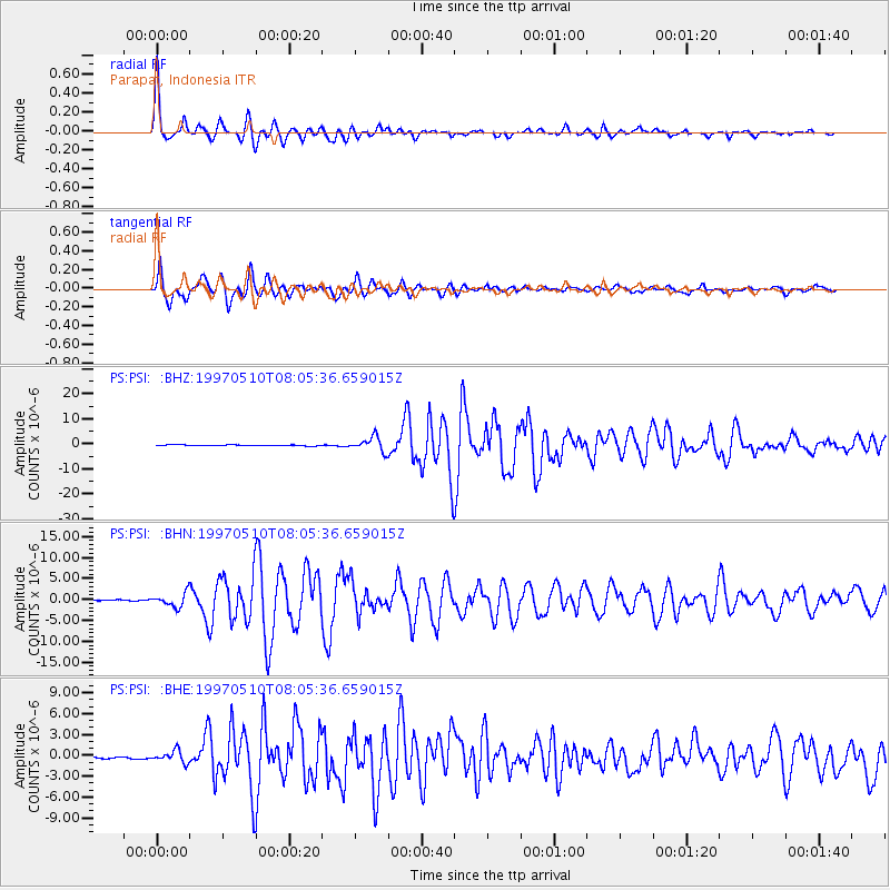
Signal To Noise
| Channel | StoN | STA | LTA |
| PS:PSI: :BHN:19970510T08:05:36.659015Z | 12.068412 | 1.6543611E-6 | 1.3708193E-7 |
| PS:PSI: :BHE:19970510T08:05:36.659015Z | 8.012273 | 8.7401276E-7 | 1.0908425E-7 |
| PS:PSI: :BHZ:19970510T08:05:36.659015Z | 14.849372 | 2.8732209E-6 | 1.9349108E-7 |
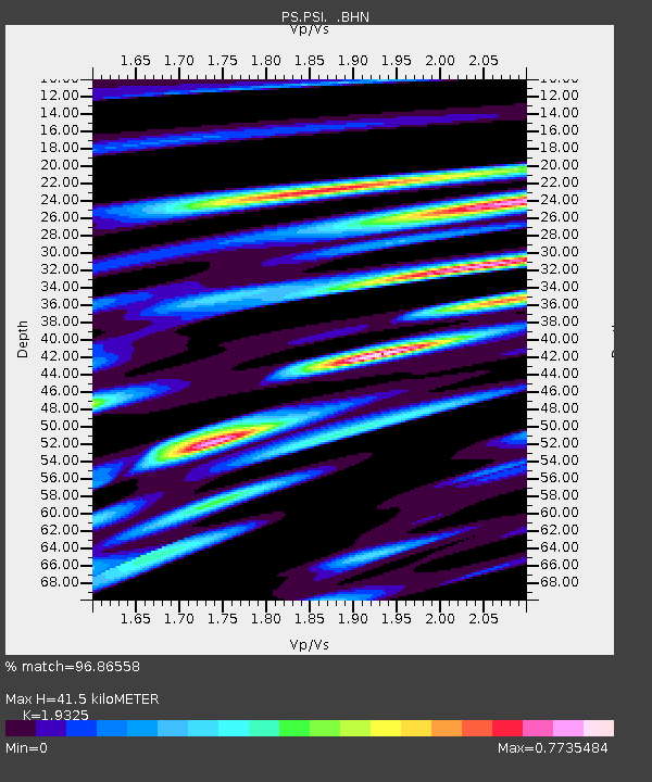
| Arrivals | |
| Ps | 6.3 SECOND |
| PpPs | 18 SECOND |
| PsPs/PpSs | 24 SECOND |

