
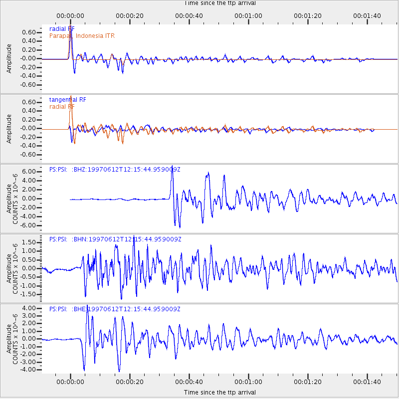
PSI Parapat, Indonesia - Earthquake Result Viewer
| ||||||||||||||||||
| ||||||||||||||||||
| ||||||||||||||||||
|
Signal To Noise
| Channel | StoN | STA | LTA |
| PS:PSI: :BHN:19970612T12:15:44.959009Z | 3.5086403 | 2.7688526E-7 | 7.8915264E-8 |
| PS:PSI: :BHE:19970612T12:15:44.959009Z | 23.29639 | 1.2632036E-6 | 5.4223147E-8 |
| PS:PSI: :BHZ:19970612T12:15:44.959009Z | 27.51464 | 2.2684703E-6 | 8.2445936E-8 |
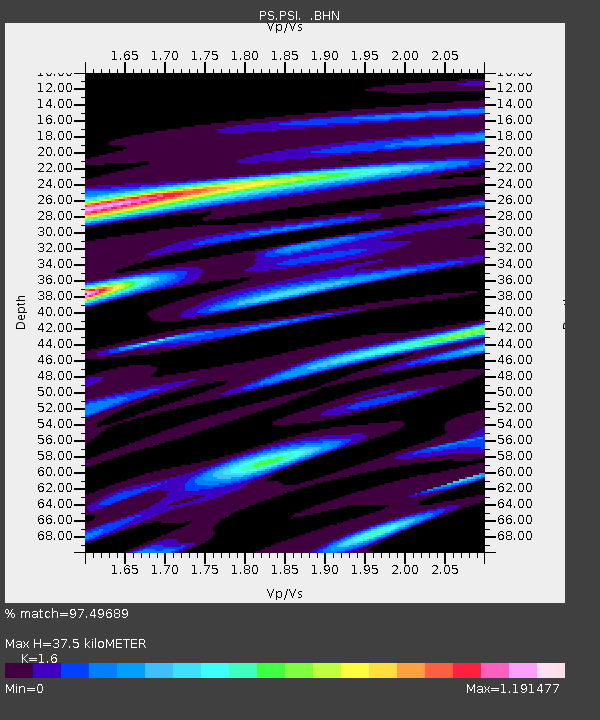
| Arrivals | |
| Ps | 3.7 SECOND |
| PpPs | 14 SECOND |
| PsPs/PpSs | 18 SECOND |

