
PSI Parapat, Indonesia - Earthquake Result Viewer
| ||||||||||||||||||
| ||||||||||||||||||
| ||||||||||||||||||
|
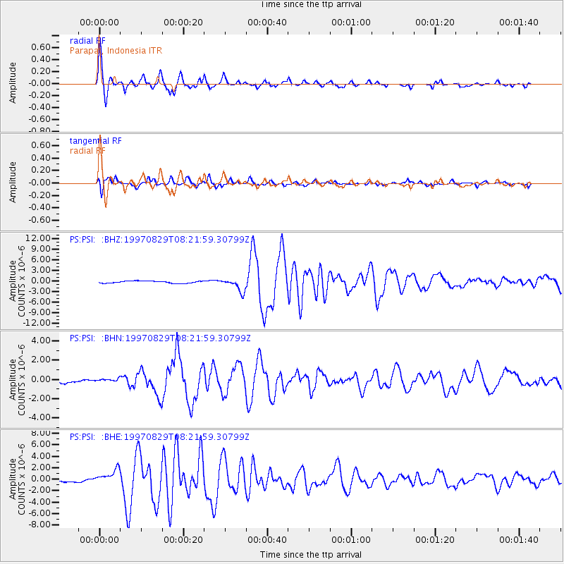
Signal To Noise
| Channel | StoN | STA | LTA |
| PS:PSI: :BHN:19970829T08:21:59.30799Z | 1.0857245 | 1.5928069E-7 | 1.4670452E-7 |
| PS:PSI: :BHE:19970829T08:21:59.30799Z | 6.1494145 | 1.3678869E-6 | 2.224418E-7 |
| PS:PSI: :BHZ:19970829T08:21:59.30799Z | 6.333827 | 1.8992337E-6 | 2.9985563E-7 |
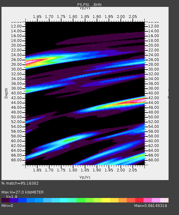
| Arrivals | |
| Ps | 2.7 SECOND |
| PpPs | 10 SECOND |
| PsPs/PpSs | 13 SECOND |

