You are here: Home > Network List > AK - Alaska Regional Network Stations List
> Station GAMB Gambell Broadband > Earthquake Result Viewer
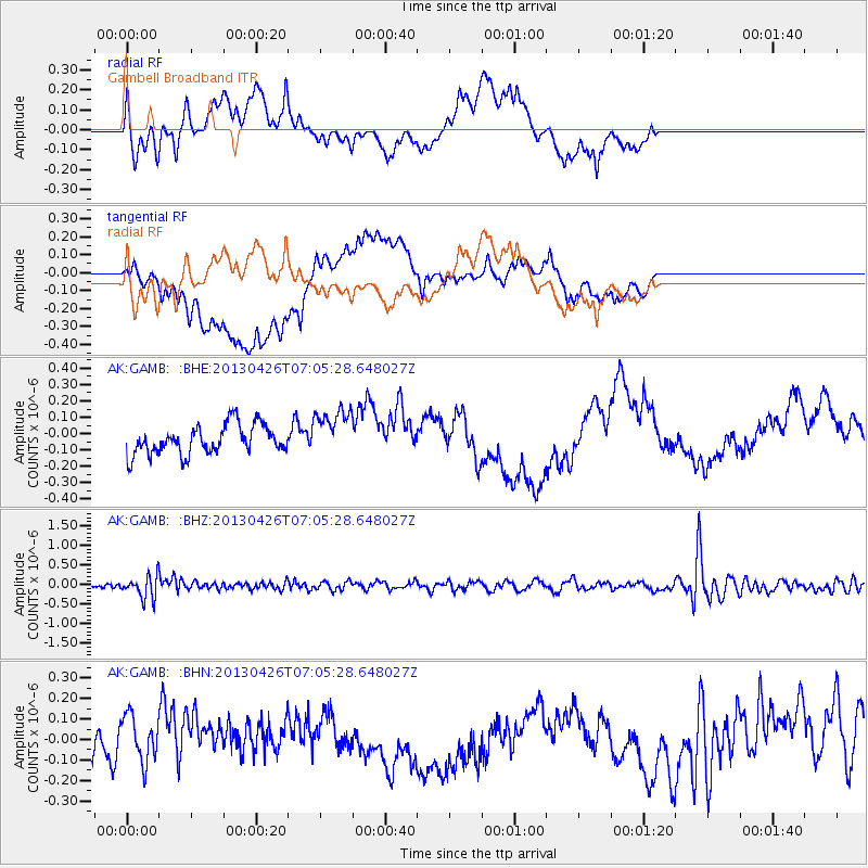
GAMB Gambell Broadband - Earthquake Result Viewer
*The percent match for this event was below the threshold and hence no stack was calculated.
| Earthquake location: |
Kermadec Islands Region |
| Earthquake latitude/longitude: |
-28.7/-178.9 |
| Earthquake time(UTC): |
2013/04/26 (116) 06:53:28 GMT |
| Earthquake Depth: |
351 km |
| Earthquake Magnitude: |
6.1 MW, 5.8 MB, 6.2 MW |
| Earthquake Catalog/Contributor: |
NEIC PDE/NEIC PDE-W |
|
| Network: |
AK Alaska Regional Network |
| Station: |
GAMB Gambell Broadband |
| Lat/Lon: |
63.78 N/171.70 W |
| Elevation: |
10 m |
|
| Distance: |
92.3 deg |
| Az: |
3.201 deg |
| Baz: |
186.341 deg |
| Ray Param: |
$rayparam |
*The percent match for this event was below the threshold and hence was not used in the summary stack. |
|
| Radial Match: |
61.288677 % |
| Radial Bump: |
400 |
| Transverse Match: |
46.045837 % |
| Transverse Bump: |
400 |
| SOD ConfigId: |
512894 |
| Insert Time: |
2013-09-13 19:34:07.879 +0000 |
| GWidth: |
2.5 |
| Max Bumps: |
400 |
| Tol: |
0.001 |
|
Signal To Noise
| Channel | StoN | STA | LTA |
| AK:GAMB: :BHZ:20130426T07:05:28.648027Z | 3.1255417 | 2.7821616E-7 | 8.901374E-8 |
| AK:GAMB: :BHN:20130426T07:05:28.648027Z | 0.7834612 | 1.1580084E-7 | 1.4780673E-7 |
| AK:GAMB: :BHE:20130426T07:05:28.648027Z | 1.6668893 | 1.501077E-7 | 9.005259E-8 |
| Arrivals |
| Ps | |
| PpPs | |
| PsPs/PpSs | |


