You are here: Home > Network List > AZ - ANZA Regional Network Stations List
> Station SMER AZ.SMER > Earthquake Result Viewer
SMER AZ.SMER - Earthquake Result Viewer
*The percent match for this event was below the threshold and hence no stack was calculated.
| Earthquake location: |
Kermadec Islands Region |
| Earthquake latitude/longitude: |
-28.7/-178.9 |
| Earthquake time(UTC): |
2013/04/26 (116) 06:53:28 GMT |
| Earthquake Depth: |
351 km |
| Earthquake Magnitude: |
6.1 MW, 5.8 MB, 6.2 MW |
| Earthquake Catalog/Contributor: |
NEIC PDE/NEIC PDE-W |
|
| Network: |
AZ ANZA Regional Network |
| Station: |
SMER AZ.SMER |
| Lat/Lon: |
33.46 N/117.17 W |
| Elevation: |
355 m |
|
| Distance: |
85.1 deg |
| Az: |
47.655 deg |
| Baz: |
230.971 deg |
| Ray Param: |
$rayparam |
*The percent match for this event was below the threshold and hence was not used in the summary stack. |
|
| Radial Match: |
71.79355 % |
| Radial Bump: |
400 |
| Transverse Match: |
57.8396 % |
| Transverse Bump: |
400 |
| SOD ConfigId: |
512894 |
| Insert Time: |
2013-09-13 19:37:20.385 +0000 |
| GWidth: |
2.5 |
| Max Bumps: |
400 |
| Tol: |
0.001 |
|
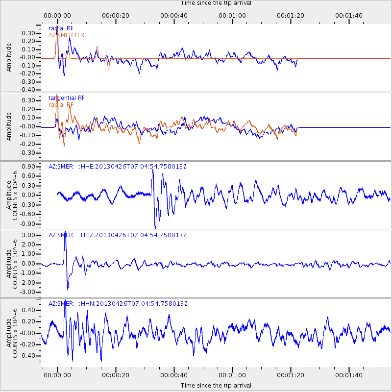
Signal To Noise
| Channel | StoN | STA | LTA |
| AZ:SMER: :HHZ:20130426T07:04:54.758013Z | 9.117366 | 1.3155825E-6 | 1.4429415E-7 |
| AZ:SMER: :HHN:20130426T07:04:54.758013Z | 1.71805 | 2.2227734E-7 | 1.2937768E-7 |
| AZ:SMER: :HHE:20130426T07:04:54.758013Z | 3.540259 | 4.0598377E-7 | 1.146763E-7 |
| Arrivals |
| Ps | |
| PpPs | |
| PsPs/PpSs | |


