You are here: Home > Network List > G - GEOSCOPE Stations List
> Station INU Inuyama, Japan > Earthquake Result Viewer
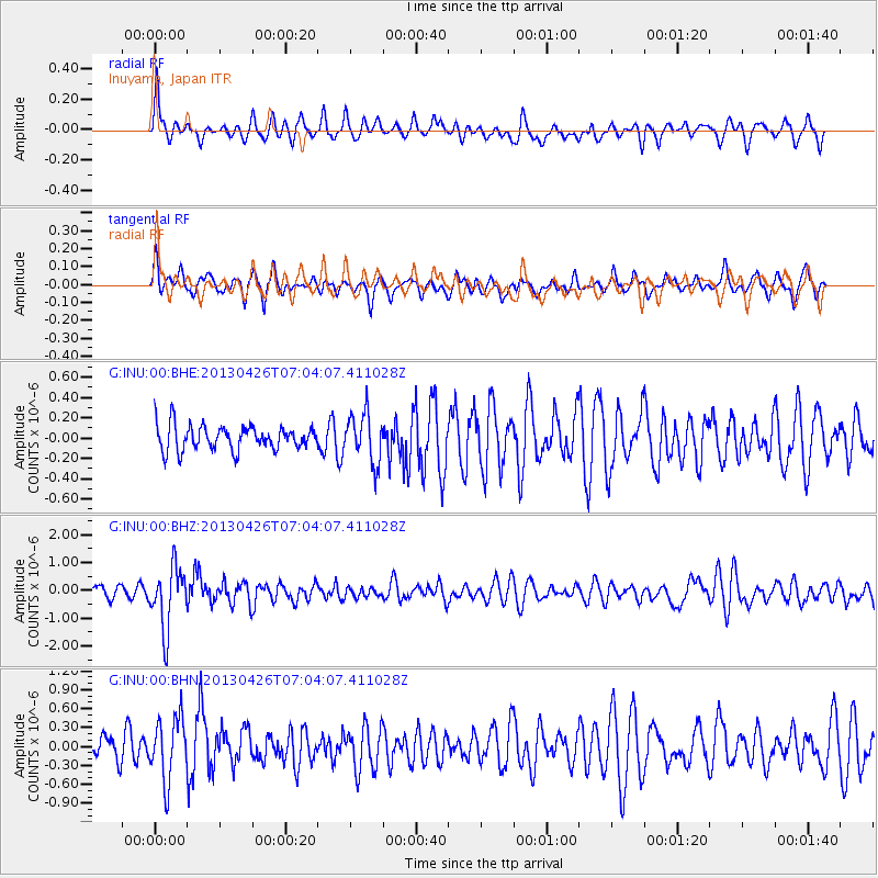
INU Inuyama, Japan - Earthquake Result Viewer
*The percent match for this event was below the threshold and hence no stack was calculated.
| Earthquake location: |
Kermadec Islands Region |
| Earthquake latitude/longitude: |
-28.7/-178.9 |
| Earthquake time(UTC): |
2013/04/26 (116) 06:53:28 GMT |
| Earthquake Depth: |
351 km |
| Earthquake Magnitude: |
6.1 MW, 5.8 MB, 6.2 MW |
| Earthquake Catalog/Contributor: |
NEIC PDE/NEIC PDE-W |
|
| Network: |
G GEOSCOPE |
| Station: |
INU Inuyama, Japan |
| Lat/Lon: |
35.35 N/137.03 E |
| Elevation: |
132 m |
|
| Distance: |
76.0 deg |
| Az: |
324.147 deg |
| Baz: |
140.982 deg |
| Ray Param: |
$rayparam |
*The percent match for this event was below the threshold and hence was not used in the summary stack. |
|
| Radial Match: |
68.26985 % |
| Radial Bump: |
343 |
| Transverse Match: |
63.404453 % |
| Transverse Bump: |
391 |
| SOD ConfigId: |
512894 |
| Insert Time: |
2013-09-13 19:41:31.196 +0000 |
| GWidth: |
2.5 |
| Max Bumps: |
400 |
| Tol: |
0.001 |
|
Signal To Noise
| Channel | StoN | STA | LTA |
| G:INU:00:BHZ:20130426T07:04:07.411028Z | 4.1260805 | 1.0926695E-6 | 2.6482024E-7 |
| G:INU:00:BHN:20130426T07:04:07.411028Z | 2.0463796 | 4.9621895E-7 | 2.424863E-7 |
| G:INU:00:BHE:20130426T07:04:07.411028Z | 2.0057056 | 2.4298652E-7 | 1.2114765E-7 |
| Arrivals |
| Ps | |
| PpPs | |
| PsPs/PpSs | |


