
PSI Parapat, Indonesia - Earthquake Result Viewer
| ||||||||||||||||||
| ||||||||||||||||||
| ||||||||||||||||||
|
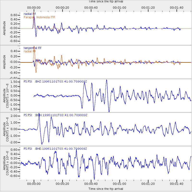
Signal To Noise
| Channel | StoN | STA | LTA |
| PS:PSI: :BHN:19961101T03:41:00.709009Z | 10.184609 | 8.8163927E-7 | 8.656584E-8 |
| PS:PSI: :BHE:19961101T03:41:00.709009Z | 0.9202787 | 7.976842E-8 | 8.667854E-8 |
| PS:PSI: :BHZ:19961101T03:41:00.709009Z | 7.8966727 | 5.3751097E-7 | 6.806803E-8 |
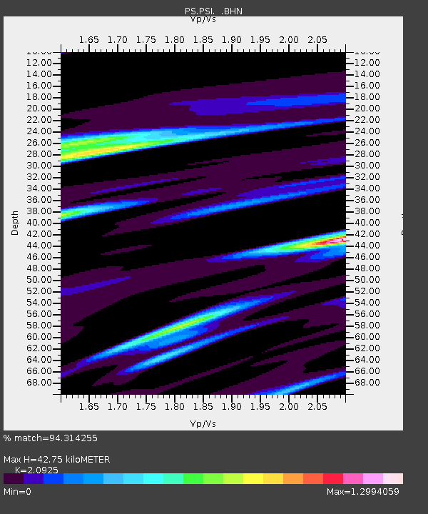
| Arrivals | |
| Ps | 7.6 SECOND |
| PpPs | 19 SECOND |
| PsPs/PpSs | 27 SECOND |

