You are here: Home > Network List > II - Global Seismograph Network (GSN - IRIS/IDA) Stations List
> Station WRAB Tennant Creek, NT, Australia > Earthquake Result Viewer
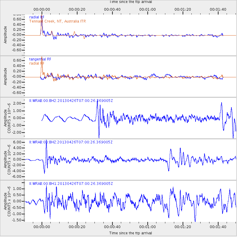
WRAB Tennant Creek, NT, Australia - Earthquake Result Viewer
*The percent match for this event was below the threshold and hence no stack was calculated.
| Earthquake location: |
Kermadec Islands Region |
| Earthquake latitude/longitude: |
-28.7/-178.9 |
| Earthquake time(UTC): |
2013/04/26 (116) 06:53:28 GMT |
| Earthquake Depth: |
351 km |
| Earthquake Magnitude: |
6.1 MW, 5.8 MB, 6.2 MW |
| Earthquake Catalog/Contributor: |
NEIC PDE/NEIC PDE-W |
|
| Network: |
II Global Seismograph Network (GSN - IRIS/IDA) |
| Station: |
WRAB Tennant Creek, NT, Australia |
| Lat/Lon: |
19.93 S/134.36 E |
| Elevation: |
366 m |
|
| Distance: |
43.2 deg |
| Az: |
270.848 deg |
| Baz: |
110.961 deg |
| Ray Param: |
$rayparam |
*The percent match for this event was below the threshold and hence was not used in the summary stack. |
|
| Radial Match: |
79.1424 % |
| Radial Bump: |
295 |
| Transverse Match: |
71.549484 % |
| Transverse Bump: |
373 |
| SOD ConfigId: |
512894 |
| Insert Time: |
2013-09-13 19:42:51.542 +0000 |
| GWidth: |
2.5 |
| Max Bumps: |
400 |
| Tol: |
0.001 |
|
Signal To Noise
| Channel | StoN | STA | LTA |
| II:WRAB:00:BHZ:20130426T07:00:26.369005Z | 7.0162177 | 2.3599212E-6 | 3.3635234E-7 |
| II:WRAB:00:BH1:20130426T07:00:26.369005Z | 2.5898457 | 5.4432513E-7 | 2.1017668E-7 |
| II:WRAB:00:BH2:20130426T07:00:26.369005Z | 4.398767 | 1.150722E-6 | 2.6160103E-7 |
| Arrivals |
| Ps | |
| PpPs | |
| PsPs/PpSs | |


