You are here: Home > Network List > IU - Global Seismograph Network (GSN - IRIS/USGS) Stations List
> Station GUMO Guam, Mariana Islands > Earthquake Result Viewer
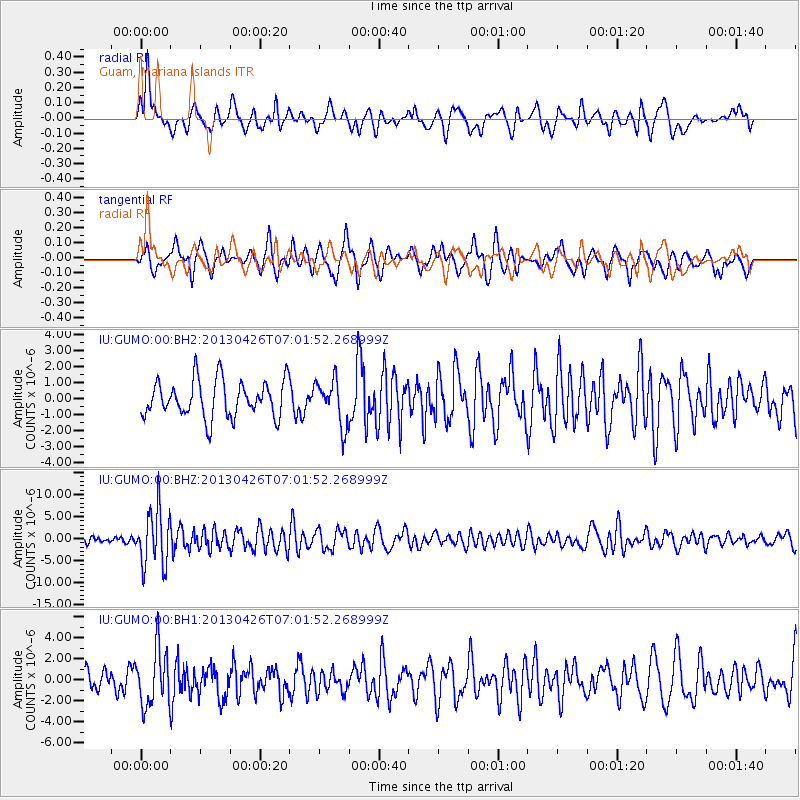
GUMO Guam, Mariana Islands - Earthquake Result Viewer
*The percent match for this event was below the threshold and hence no stack was calculated.
| Earthquake location: |
Kermadec Islands Region |
| Earthquake latitude/longitude: |
-28.7/-178.9 |
| Earthquake time(UTC): |
2013/04/26 (116) 06:53:28 GMT |
| Earthquake Depth: |
351 km |
| Earthquake Magnitude: |
6.1 MW, 5.8 MB, 6.2 MW |
| Earthquake Catalog/Contributor: |
NEIC PDE/NEIC PDE-W |
|
| Network: |
IU Global Seismograph Network (GSN - IRIS/USGS) |
| Station: |
GUMO Guam, Mariana Islands |
| Lat/Lon: |
13.59 N/144.87 E |
| Elevation: |
170 m |
|
| Distance: |
54.7 deg |
| Az: |
315.259 deg |
| Baz: |
140.5 deg |
| Ray Param: |
$rayparam |
*The percent match for this event was below the threshold and hence was not used in the summary stack. |
|
| Radial Match: |
65.31451 % |
| Radial Bump: |
400 |
| Transverse Match: |
60.72017 % |
| Transverse Bump: |
400 |
| SOD ConfigId: |
512894 |
| Insert Time: |
2013-09-13 19:43:21.134 +0000 |
| GWidth: |
2.5 |
| Max Bumps: |
400 |
| Tol: |
0.001 |
|
Signal To Noise
| Channel | StoN | STA | LTA |
| IU:GUMO:00:BHZ:20130426T07:01:52.268999Z | 7.031471 | 6.4269702E-6 | 9.1402933E-7 |
| IU:GUMO:00:BH1:20130426T07:01:52.268999Z | 2.9024484 | 2.711481E-6 | 9.342047E-7 |
| IU:GUMO:00:BH2:20130426T07:01:52.268999Z | 1.237316 | 1.4269663E-6 | 1.1532755E-6 |
| Arrivals |
| Ps | |
| PpPs | |
| PsPs/PpSs | |


