You are here: Home > Network List > TA - USArray Transportable Network (new EarthScope stations) Stations List
> Station A04D Lummi Island, WA, USA > Earthquake Result Viewer
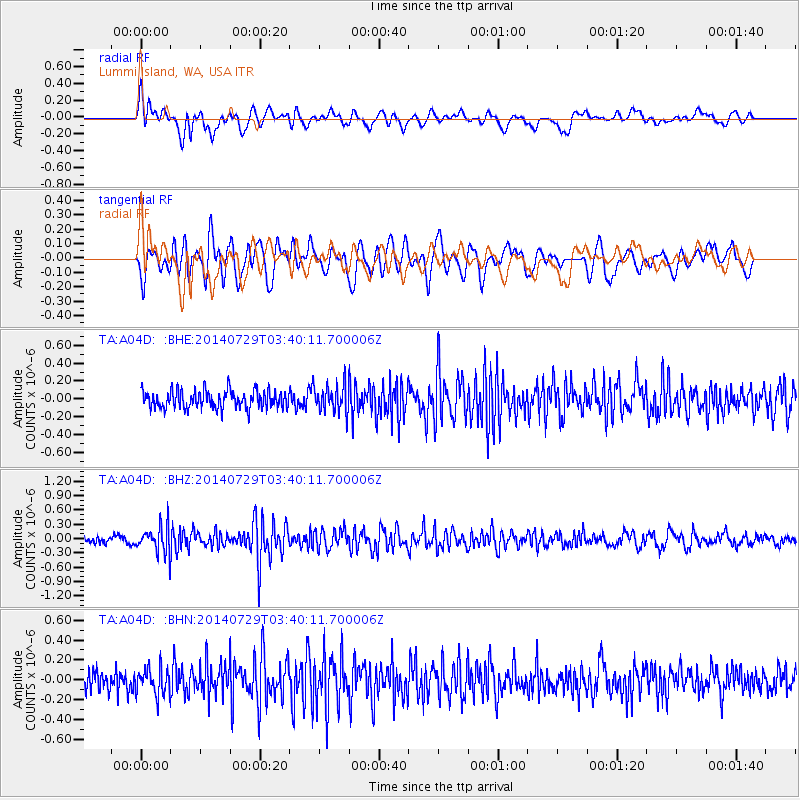
A04D Lummi Island, WA, USA - Earthquake Result Viewer
*The percent match for this event was below the threshold and hence no stack was calculated.
| Earthquake location: |
Near Coast Of Chiapas, Mexico |
| Earthquake latitude/longitude: |
14.8/-92.4 |
| Earthquake time(UTC): |
2014/07/29 (210) 03:32:59 GMT |
| Earthquake Depth: |
87 km |
| Earthquake Magnitude: |
5.3 MW, 5.5 mb, 4.5 MS |
| Earthquake Catalog/Contributor: |
ISC/ISC |
|
| Network: |
TA USArray Transportable Network (new EarthScope stations) |
| Station: |
A04D Lummi Island, WA, USA |
| Lat/Lon: |
48.72 N/122.71 W |
| Elevation: |
13 m |
|
| Distance: |
42.0 deg |
| Az: |
330.045 deg |
| Baz: |
133.173 deg |
| Ray Param: |
$rayparam |
*The percent match for this event was below the threshold and hence was not used in the summary stack. |
|
| Radial Match: |
65.84808 % |
| Radial Bump: |
400 |
| Transverse Match: |
57.077732 % |
| Transverse Bump: |
400 |
| SOD ConfigId: |
3390531 |
| Insert Time: |
2019-04-13 02:01:19.206 +0000 |
| GWidth: |
2.5 |
| Max Bumps: |
400 |
| Tol: |
0.001 |
|
Signal To Noise
| Channel | StoN | STA | LTA |
| TA:A04D: :BHZ:20140729T03:40:11.700006Z | 4.1112823 | 2.7454433E-7 | 6.677827E-8 |
| TA:A04D: :BHN:20140729T03:40:11.700006Z | 1.1618031 | 1.3238387E-7 | 1.1394691E-7 |
| TA:A04D: :BHE:20140729T03:40:11.700006Z | 1.5709807 | 1.5507439E-7 | 9.871184E-8 |
| Arrivals |
| Ps | |
| PpPs | |
| PsPs/PpSs | |


