You are here: Home > Network List > TA - USArray Transportable Network (new EarthScope stations) Stations List
> Station J04D Umpqua National Forest, Toketee, OR, USA > Earthquake Result Viewer
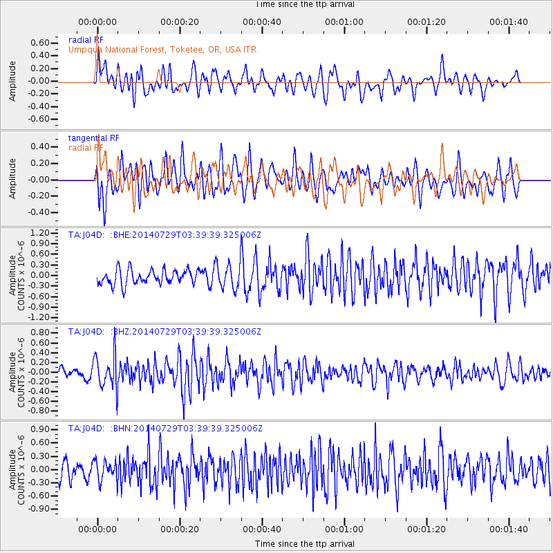
J04D Umpqua National Forest, Toketee, OR, USA - Earthquake Result Viewer
*The percent match for this event was below the threshold and hence no stack was calculated.
| Earthquake location: |
Near Coast Of Chiapas, Mexico |
| Earthquake latitude/longitude: |
14.8/-92.4 |
| Earthquake time(UTC): |
2014/07/29 (210) 03:32:59 GMT |
| Earthquake Depth: |
87 km |
| Earthquake Magnitude: |
5.3 MW, 5.5 mb, 4.5 MS |
| Earthquake Catalog/Contributor: |
ISC/ISC |
|
| Network: |
TA USArray Transportable Network (new EarthScope stations) |
| Station: |
J04D Umpqua National Forest, Toketee, OR, USA |
| Lat/Lon: |
43.24 N/122.11 W |
| Elevation: |
1948 m |
|
| Distance: |
38.1 deg |
| Az: |
324.047 deg |
| Baz: |
129.004 deg |
| Ray Param: |
$rayparam |
*The percent match for this event was below the threshold and hence was not used in the summary stack. |
|
| Radial Match: |
56.20621 % |
| Radial Bump: |
400 |
| Transverse Match: |
69.98837 % |
| Transverse Bump: |
400 |
| SOD ConfigId: |
3390531 |
| Insert Time: |
2019-04-13 02:01:41.467 +0000 |
| GWidth: |
2.5 |
| Max Bumps: |
400 |
| Tol: |
0.001 |
|
Signal To Noise
| Channel | StoN | STA | LTA |
| TA:J04D: :BHZ:20140729T03:39:39.325006Z | 2.9736178 | 3.495144E-7 | 1.1753845E-7 |
| TA:J04D: :BHN:20140729T03:39:39.325006Z | 1.1373988 | 2.2116674E-7 | 1.944496E-7 |
| TA:J04D: :BHE:20140729T03:39:39.325006Z | 1.7145218 | 3.520876E-7 | 2.0535616E-7 |
| Arrivals |
| Ps | |
| PpPs | |
| PsPs/PpSs | |


