You are here: Home > Network List > TA - USArray Transportable Network (new EarthScope stations) Stations List
> Station Y12C Blythe, CA, USA > Earthquake Result Viewer
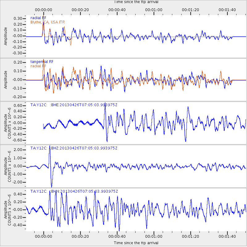
Y12C Blythe, CA, USA - Earthquake Result Viewer
*The percent match for this event was below the threshold and hence no stack was calculated.
| Earthquake location: |
Kermadec Islands Region |
| Earthquake latitude/longitude: |
-28.7/-178.9 |
| Earthquake time(UTC): |
2013/04/26 (116) 06:53:28 GMT |
| Earthquake Depth: |
351 km |
| Earthquake Magnitude: |
6.1 MW, 5.8 MB, 6.2 MW |
| Earthquake Catalog/Contributor: |
NEIC PDE/NEIC PDE-W |
|
| Network: |
TA USArray Transportable Network (new EarthScope stations) |
| Station: |
Y12C Blythe, CA, USA |
| Lat/Lon: |
33.75 N/114.52 W |
| Elevation: |
196 m |
|
| Distance: |
87.0 deg |
| Az: |
48.797 deg |
| Baz: |
232.508 deg |
| Ray Param: |
$rayparam |
*The percent match for this event was below the threshold and hence was not used in the summary stack. |
|
| Radial Match: |
73.64873 % |
| Radial Bump: |
400 |
| Transverse Match: |
74.16061 % |
| Transverse Bump: |
400 |
| SOD ConfigId: |
512894 |
| Insert Time: |
2013-09-13 19:49:30.457 +0000 |
| GWidth: |
2.5 |
| Max Bumps: |
400 |
| Tol: |
0.001 |
|
Signal To Noise
| Channel | StoN | STA | LTA |
| TA:Y12C: :BHZ:20130426T07:05:03.993975Z | 17.074778 | 1.15169E-6 | 6.7449776E-8 |
| TA:Y12C: :BHN:20130426T07:05:03.993975Z | 2.6240396 | 1.7544636E-7 | 6.686117E-8 |
| TA:Y12C: :BHE:20130426T07:05:03.993975Z | 3.6428828 | 2.877553E-7 | 7.89911E-8 |
| Arrivals |
| Ps | |
| PpPs | |
| PsPs/PpSs | |


