You are here: Home > Network List > UW - Pacific Northwest Regional Seismic Network Stations List
> Station MRBL Marblemount, WA, USA > Earthquake Result Viewer
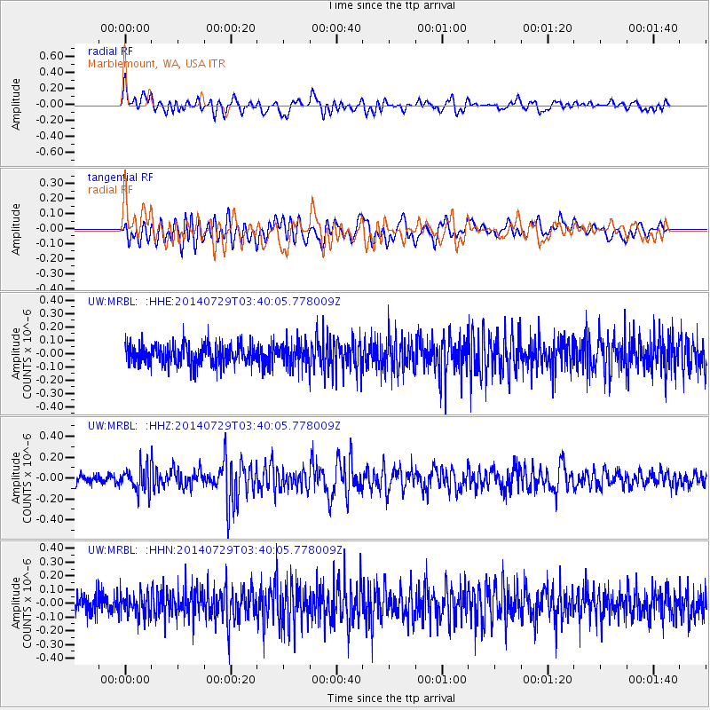
MRBL Marblemount, WA, USA - Earthquake Result Viewer
*The percent match for this event was below the threshold and hence no stack was calculated.
| Earthquake location: |
Near Coast Of Chiapas, Mexico |
| Earthquake latitude/longitude: |
14.8/-92.4 |
| Earthquake time(UTC): |
2014/07/29 (210) 03:32:59 GMT |
| Earthquake Depth: |
87 km |
| Earthquake Magnitude: |
5.3 MW, 5.5 mb, 4.5 MS |
| Earthquake Catalog/Contributor: |
ISC/ISC |
|
| Network: |
UW Pacific Northwest Regional Seismic Network |
| Station: |
MRBL Marblemount, WA, USA |
| Lat/Lon: |
48.52 N/121.48 W |
| Elevation: |
75 m |
|
| Distance: |
41.3 deg |
| Az: |
330.671 deg |
| Baz: |
134.556 deg |
| Ray Param: |
$rayparam |
*The percent match for this event was below the threshold and hence was not used in the summary stack. |
|
| Radial Match: |
65.855576 % |
| Radial Bump: |
400 |
| Transverse Match: |
58.734688 % |
| Transverse Bump: |
400 |
| SOD ConfigId: |
3390531 |
| Insert Time: |
2019-04-13 02:02:24.562 +0000 |
| GWidth: |
2.5 |
| Max Bumps: |
400 |
| Tol: |
0.001 |
|
Signal To Noise
| Channel | StoN | STA | LTA |
| UW:MRBL: :HHZ:20140729T03:40:05.778009Z | 2.1132178 | 1.1815227E-7 | 5.5911073E-8 |
| UW:MRBL: :HHN:20140729T03:40:05.778009Z | 1.1283761 | 7.9657845E-8 | 7.059512E-8 |
| UW:MRBL: :HHE:20140729T03:40:05.778009Z | 1.1009723 | 8.20645E-8 | 7.453821E-8 |
| Arrivals |
| Ps | |
| PpPs | |
| PsPs/PpSs | |


