
PSI Parapat, Indonesia - Earthquake Result Viewer
| ||||||||||||||||||
| ||||||||||||||||||
| ||||||||||||||||||
|
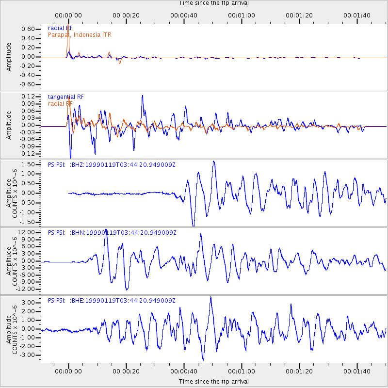
Signal To Noise
| Channel | StoN | STA | LTA |
| PS:PSI: :BHN:19990119T03:44:20.949009Z | 1.2105916 | 1.1648911E-7 | 9.622495E-8 |
| PS:PSI: :BHE:19990119T03:44:20.949009Z | 1.6223857 | 1.4322409E-7 | 8.827992E-8 |
| PS:PSI: :BHZ:19990119T03:44:20.949009Z | 2.557915 | 5.9475276E-8 | 2.3251468E-8 |
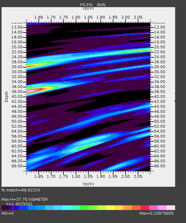
| Arrivals | |
| Ps | 3.7 SECOND |
| PpPs | 14 SECOND |
| PsPs/PpSs | 18 SECOND |

