PSI Parapat, Indonesia - Earthquake Result Viewer
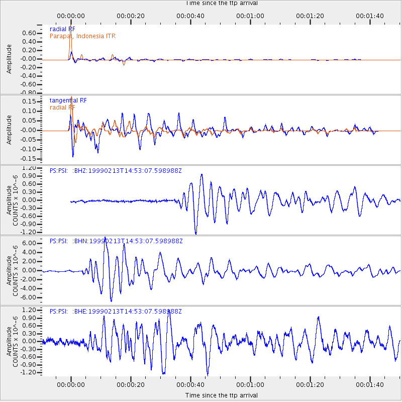
Earthquake location: Near N Coast Of New Guinea, P.N.G.
Earthquake latitude/longitude: -3.6/144.8
Earthquake time(UTC): 1999/02/13 (044) 14:45:12 GMT
Earthquake Depth: 10 km
Earthquake Magnitude: 5.6 MB, 6.3 MS, 6.3 MW, 6.2 MW
Earthquake Catalog/Contributor: WHDF/NEIC
Network: PS Pacific21
Station: PSI Parapat, Indonesia
Lat/Lon: 2.69 N/98.92 E
Elevation: 987 m
Distance: 46.3 deg
Az: 277.107 deg
Baz: 97.471 deg
Ray Param: 0.0707294
Estimated Moho Depth: 43.5 km
Estimated Crust Vp/Vs: 2.06
Assumed Crust Vp: 6.468 km/s
Estimated Crust Vs: 3.136 km/s
Estimated Crust Poisson's Ratio: 0.35
Radial Match: 98.07098 %
Radial Bump: 299
Transverse Match: 94.09887 %
Transverse Bump: 385
SOD ConfigId: 4480
Insert Time: 2010-02-27 03:21:40.698 +0000
GWidth: 2.5
Max Bumps: 400
Tol: 0.001

Signal To Noise

ChannelStoNSTALTA
PS:PSI: :BHN:19990213T14:53:07.598988Z2.42697672.166086E-78.9250385E-8
PS:PSI: :BHE:19990213T14:53:07.598988Z1.04971898.2016506E-87.8131876E-8
PS:PSI: :BHZ:19990213T14:53:07.598988Z1.17314082.5505418E-82.174114E-8
Arrivals
Ps7.5 SECOND
PpPs20 SECOND
PsPs/PpSs27 SECOND