You are here: Home > Network List > CN - Canadian National Seismograph Network Stations List
> Station INK INUVIK, NT > Earthquake Result Viewer
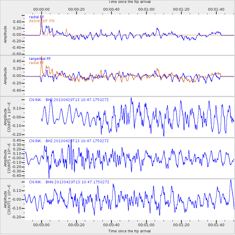
INK INUVIK, NT - Earthquake Result Viewer
*The percent match for this event was below the threshold and hence no stack was calculated.
| Earthquake location: |
Near East Coast Of Honshu, Japan |
| Earthquake latitude/longitude: |
35.7/141.0 |
| Earthquake time(UTC): |
2013/04/29 (119) 13:01:44 GMT |
| Earthquake Depth: |
35 km |
| Earthquake Magnitude: |
5.6 MW, 5.5 MW |
| Earthquake Catalog/Contributor: |
NEIC PDE/NEIC PDE-W |
|
| Network: |
CN Canadian National Seismograph Network |
| Station: |
INK INUVIK, NT |
| Lat/Lon: |
68.31 N/133.53 W |
| Elevation: |
44 m |
|
| Distance: |
55.7 deg |
| Az: |
26.648 deg |
| Baz: |
280.928 deg |
| Ray Param: |
$rayparam |
*The percent match for this event was below the threshold and hence was not used in the summary stack. |
|
| Radial Match: |
60.35833 % |
| Radial Bump: |
400 |
| Transverse Match: |
52.390537 % |
| Transverse Bump: |
400 |
| SOD ConfigId: |
512894 |
| Insert Time: |
2013-09-13 20:02:07.096 +0000 |
| GWidth: |
2.5 |
| Max Bumps: |
400 |
| Tol: |
0.001 |
|
Signal To Noise
| Channel | StoN | STA | LTA |
| CN:INK: :BHZ:20130429T13:10:47.175027Z | 2.1188478 | 1.6379354E-7 | 7.730312E-8 |
| CN:INK: :BHN:20130429T13:10:47.175027Z | 0.8998357 | 5.1783072E-8 | 5.754725E-8 |
| CN:INK: :BHE:20130429T13:10:47.175027Z | 1.0125709 | 7.2448145E-8 | 7.154871E-8 |
| Arrivals |
| Ps | |
| PpPs | |
| PsPs/PpSs | |


