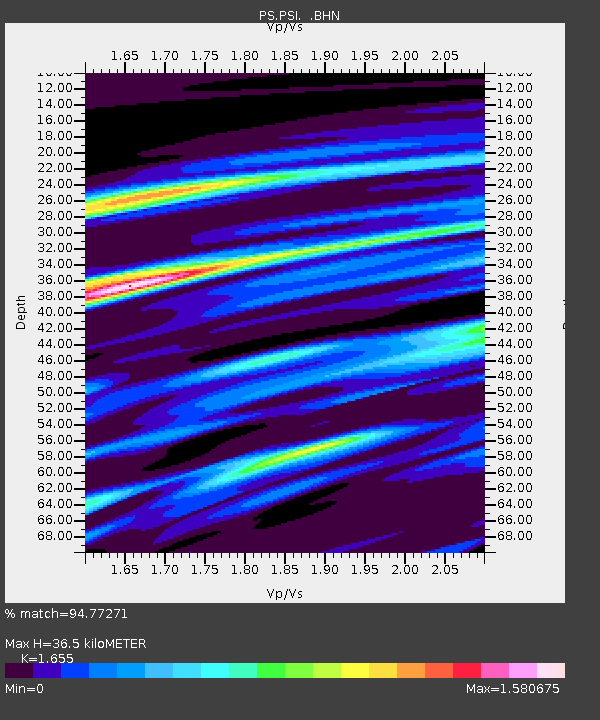
PSI Parapat, Indonesia - Earthquake Result Viewer
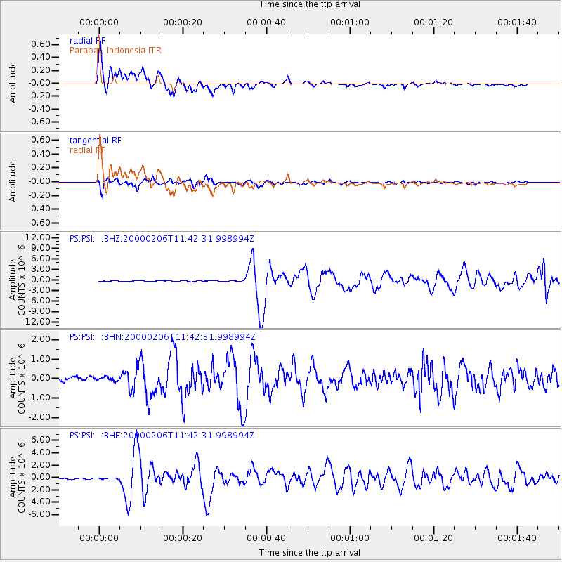
Earthquake location: New Britain Region, P.N.G.
Earthquake latitude/longitude: -5.8/150.9
Earthquake time(UTC): 2000/02/06 (037) 11:33:52 GMT
Earthquake Depth: 33 km
Earthquake Magnitude: 6.6 MB, 6.8 MS, 6.6 MW, 6.3 ME
Earthquake Catalog/Contributor: WHDF/NEIC
Network: PS Pacific21
Station: PSI Parapat, Indonesia
Lat/Lon: 2.69 N/98.92 E
Elevation: 987 m
Distance: 52.6 deg
Az: 277.869 deg
Baz: 99.397 deg
Ray Param: 0.06661335
Estimated Moho Depth: 36.5 km
Estimated Crust Vp/Vs: 1.65
Assumed Crust Vp: 6.468 km/s
Estimated Crust Vs: 3.908 km/s
Estimated Crust Poisson's Ratio: 0.21
Radial Match: 94.77271 %
Radial Bump: 400
Transverse Match: 93.22583 %
Transverse Bump: 400
SOD ConfigId: 3744
Insert Time: 2010-02-27 03:21:50.904 +0000
GWidth: 2.5
Max Bumps: 400
Tol: 0.001

Signal To Noise

ChannelStoNSTALTA
PS:PSI: :BHN:20000206T11:42:31.998994Z1.12497741.01027545E-78.980407E-8
PS:PSI: :BHE:20000206T11:42:31.998994Z1.12986532.1179619E-71.8745261E-7
PS:PSI: :BHZ:20000206T11:42:31.998994Z1.44613241.2008759E-78.304052E-8
Arrivals
Ps3.9 SECOND
PpPs14 SECOND
PsPs/PpSs18 SECOND