You are here: Home > Network List > TA - USArray Transportable Network (new EarthScope stations) Stations List
> Station O41A Passley's Farm, La Prairie, IL, USA > Earthquake Result Viewer
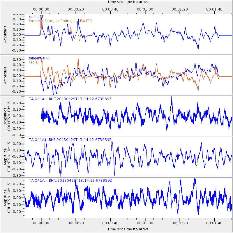
O41A Passley's Farm, La Prairie, IL, USA - Earthquake Result Viewer
*The percent match for this event was below the threshold and hence no stack was calculated.
| Earthquake location: |
Near East Coast Of Honshu, Japan |
| Earthquake latitude/longitude: |
35.7/141.0 |
| Earthquake time(UTC): |
2013/04/29 (119) 13:01:44 GMT |
| Earthquake Depth: |
35 km |
| Earthquake Magnitude: |
5.6 MW, 5.5 MW |
| Earthquake Catalog/Contributor: |
NEIC PDE/NEIC PDE-W |
|
| Network: |
TA USArray Transportable Network (new EarthScope stations) |
| Station: |
O41A Passley's Farm, La Prairie, IL, USA |
| Lat/Lon: |
40.12 N/90.88 W |
| Elevation: |
203 m |
|
| Distance: |
90.7 deg |
| Az: |
37.1 deg |
| Baz: |
320.193 deg |
| Ray Param: |
$rayparam |
*The percent match for this event was below the threshold and hence was not used in the summary stack. |
|
| Radial Match: |
61.582214 % |
| Radial Bump: |
400 |
| Transverse Match: |
37.347797 % |
| Transverse Bump: |
400 |
| SOD ConfigId: |
512894 |
| Insert Time: |
2013-09-13 20:20:40.464 +0000 |
| GWidth: |
2.5 |
| Max Bumps: |
400 |
| Tol: |
0.001 |
|
Signal To Noise
| Channel | StoN | STA | LTA |
| TA:O41A: :BHZ:20130429T13:14:12.673989Z | 2.0243878 | 1.3080125E-7 | 6.461275E-8 |
| TA:O41A: :BHN:20130429T13:14:12.673989Z | 0.77589524 | 6.699314E-8 | 8.634302E-8 |
| TA:O41A: :BHE:20130429T13:14:12.673989Z | 1.2494606 | 9.1778126E-8 | 7.34542E-8 |
| Arrivals |
| Ps | |
| PpPs | |
| PsPs/PpSs | |


