You are here: Home > Network List > TA - USArray Transportable Network (new EarthScope stations) Stations List
> Station O49A Covington, OH, USA > Earthquake Result Viewer
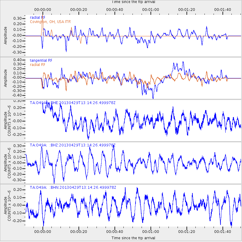
O49A Covington, OH, USA - Earthquake Result Viewer
*The percent match for this event was below the threshold and hence no stack was calculated.
| Earthquake location: |
Near East Coast Of Honshu, Japan |
| Earthquake latitude/longitude: |
35.7/141.0 |
| Earthquake time(UTC): |
2013/04/29 (119) 13:01:44 GMT |
| Earthquake Depth: |
35 km |
| Earthquake Magnitude: |
5.6 MW, 5.5 MW |
| Earthquake Catalog/Contributor: |
NEIC PDE/NEIC PDE-W |
|
| Network: |
TA USArray Transportable Network (new EarthScope stations) |
| Station: |
O49A Covington, OH, USA |
| Lat/Lon: |
40.19 N/84.34 W |
| Elevation: |
292 m |
|
| Distance: |
93.7 deg |
| Az: |
33.08 deg |
| Baz: |
324.556 deg |
| Ray Param: |
$rayparam |
*The percent match for this event was below the threshold and hence was not used in the summary stack. |
|
| Radial Match: |
52.803463 % |
| Radial Bump: |
400 |
| Transverse Match: |
47.46857 % |
| Transverse Bump: |
400 |
| SOD ConfigId: |
512894 |
| Insert Time: |
2013-09-13 20:20:51.214 +0000 |
| GWidth: |
2.5 |
| Max Bumps: |
400 |
| Tol: |
0.001 |
|
Signal To Noise
| Channel | StoN | STA | LTA |
| TA:O49A: :BHZ:20130429T13:14:26.499978Z | 1.6400391 | 1.3414149E-7 | 8.179164E-8 |
| TA:O49A: :BHN:20130429T13:14:26.499978Z | 0.9805933 | 1.3429917E-7 | 1.3695706E-7 |
| TA:O49A: :BHE:20130429T13:14:26.499978Z | 1.0043914 | 1.2188724E-7 | 1.2135432E-7 |
| Arrivals |
| Ps | |
| PpPs | |
| PsPs/PpSs | |


