You are here: Home > Network List > TA - USArray Transportable Network (new EarthScope stations) Stations List
> Station P59A Jarrettsville, MD, USA > Earthquake Result Viewer
P59A Jarrettsville, MD, USA - Earthquake Result Viewer
*The percent match for this event was below the threshold and hence no stack was calculated.
| Earthquake location: |
Near East Coast Of Honshu, Japan |
| Earthquake latitude/longitude: |
35.7/141.0 |
| Earthquake time(UTC): |
2013/04/29 (119) 13:01:44 GMT |
| Earthquake Depth: |
35 km |
| Earthquake Magnitude: |
5.6 MW, 5.5 MW |
| Earthquake Catalog/Contributor: |
NEIC PDE/NEIC PDE-W |
|
| Network: |
TA USArray Transportable Network (new EarthScope stations) |
| Station: |
P59A Jarrettsville, MD, USA |
| Lat/Lon: |
39.61 N/76.43 W |
| Elevation: |
157 m |
|
| Distance: |
97.5 deg |
| Az: |
28.253 deg |
| Baz: |
330.083 deg |
| Ray Param: |
$rayparam |
*The percent match for this event was below the threshold and hence was not used in the summary stack. |
|
| Radial Match: |
45.855244 % |
| Radial Bump: |
400 |
| Transverse Match: |
46.256184 % |
| Transverse Bump: |
400 |
| SOD ConfigId: |
512894 |
| Insert Time: |
2013-09-13 20:21:25.152 +0000 |
| GWidth: |
2.5 |
| Max Bumps: |
400 |
| Tol: |
0.001 |
|
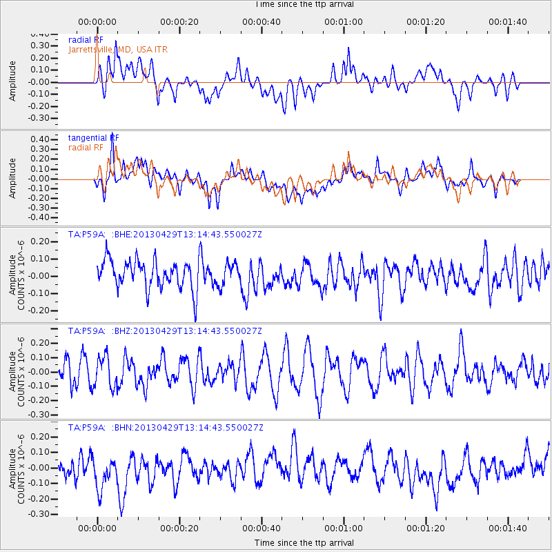
Signal To Noise
| Channel | StoN | STA | LTA |
| TA:P59A: :BHZ:20130429T13:14:43.550027Z | 1.1860105 | 1.06231305E-7 | 8.9570285E-8 |
| TA:P59A: :BHN:20130429T13:14:43.550027Z | 1.3271956 | 1.5203732E-7 | 1.1455531E-7 |
| TA:P59A: :BHE:20130429T13:14:43.550027Z | 0.77528495 | 6.3326304E-8 | 8.168133E-8 |
| Arrivals |
| Ps | |
| PpPs | |
| PsPs/PpSs | |


