
PSI Parapat, Indonesia - Earthquake Result Viewer
| ||||||||||||||||||
| ||||||||||||||||||
| ||||||||||||||||||
|
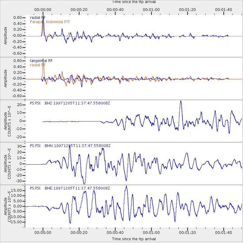
Signal To Noise
| Channel | StoN | STA | LTA |
| PS:PSI: :BHN:19971205T11:37:47.558008Z | 5.3105993 | 3.2290393E-6 | 6.080367E-7 |
| PS:PSI: :BHE:19971205T11:37:47.558008Z | 12.671657 | 1.6112207E-6 | 1.2715154E-7 |
| PS:PSI: :BHZ:19971205T11:37:47.558008Z | 6.5371537 | 9.0205083E-7 | 1.3798832E-7 |
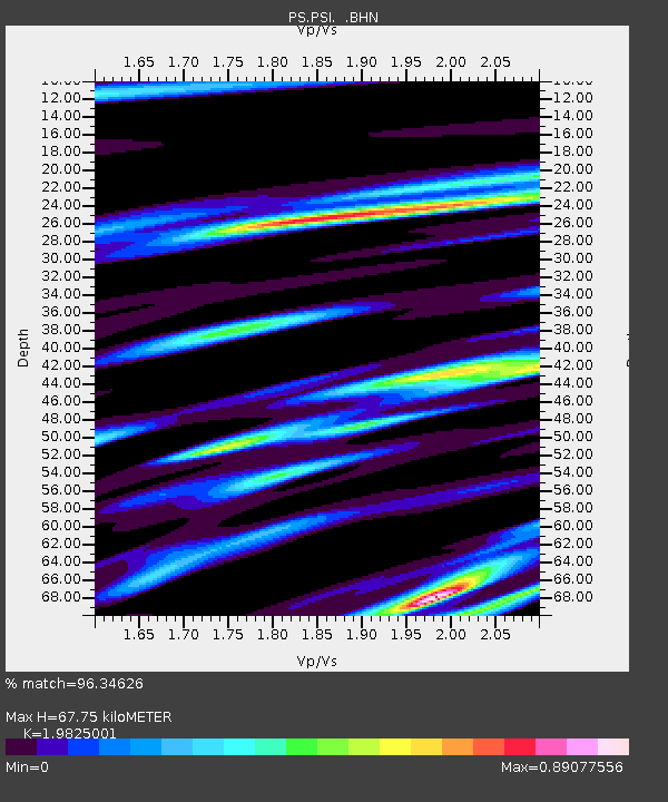
| Arrivals | |
| Ps | 11 SECOND |
| PpPs | 30 SECOND |
| PsPs/PpSs | 41 SECOND |

