
PSI Parapat, Indonesia - Earthquake Result Viewer

| ||||||||||||||||||
| ||||||||||||||||||
| ||||||||||||||||||
|
Signal To Noise
| Channel | StoN | STA | LTA |
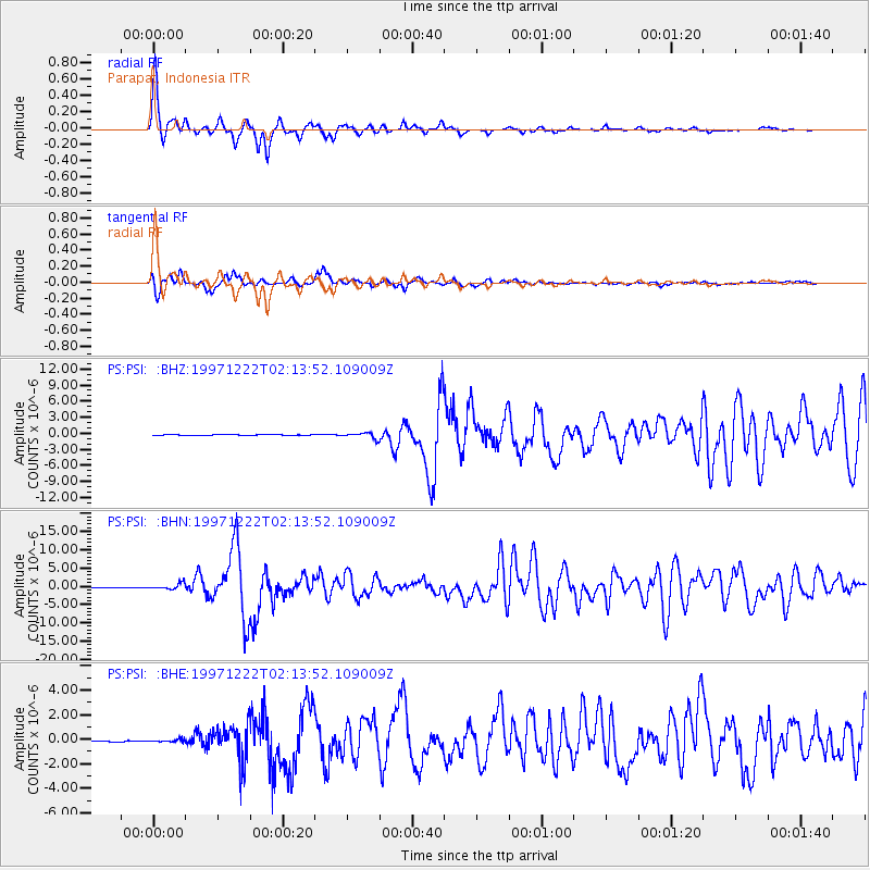
| PS:PSI: :BHN:19971222T02:13:52.109009Z | 13.030392 | 8.120101E-7 | 6.231663E-8 |
| PS:PSI: :BHE:19971222T02:13:52.109009Z | 1.416395 | 1.1798112E-7 | 8.329677E-8 |
| PS:PSI: :BHZ:19971222T02:13:52.109009Z | 7.6587577 | 5.165939E-7 | 6.7451396E-8 |
| Arrivals | |
| Ps | 2.7 SECOND |
| PpPs | 10 SECOND |
| PsPs/PpSs | 13 SECOND |

