You are here: Home > Network List > IW - Intermountain West Stations List
> Station MOOW Moose Ponds, Wyoming, USA > Earthquake Result Viewer
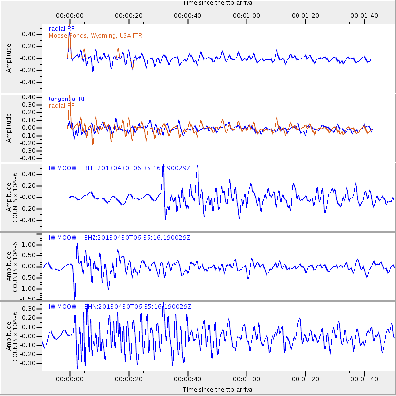
MOOW Moose Ponds, Wyoming, USA - Earthquake Result Viewer
*The percent match for this event was below the threshold and hence no stack was calculated.
| Earthquake location: |
Azores Islands Region |
| Earthquake latitude/longitude: |
37.6/-24.9 |
| Earthquake time(UTC): |
2013/04/30 (120) 06:25:23 GMT |
| Earthquake Depth: |
10 km |
| Earthquake Magnitude: |
5.8 MW, 5.9 MW, 5.9 MB |
| Earthquake Catalog/Contributor: |
NEIC PDE/NEIC PDE-W |
|
| Network: |
IW Intermountain West |
| Station: |
MOOW Moose Ponds, Wyoming, USA |
| Lat/Lon: |
43.75 N/110.74 W |
| Elevation: |
2128 m |
|
| Distance: |
62.6 deg |
| Az: |
305.49 deg |
| Baz: |
63.186 deg |
| Ray Param: |
$rayparam |
*The percent match for this event was below the threshold and hence was not used in the summary stack. |
|
| Radial Match: |
69.65082 % |
| Radial Bump: |
400 |
| Transverse Match: |
72.7725 % |
| Transverse Bump: |
400 |
| SOD ConfigId: |
512894 |
| Insert Time: |
2013-09-13 20:44:07.492 +0000 |
| GWidth: |
2.5 |
| Max Bumps: |
400 |
| Tol: |
0.001 |
|
Signal To Noise
| Channel | StoN | STA | LTA |
| IW:MOOW: :BHZ:20130430T06:35:16.190029Z | 6.3922296 | 5.3769463E-7 | 8.411692E-8 |
| IW:MOOW: :BHN:20130430T06:35:16.190029Z | 2.6827135 | 1.4804894E-7 | 5.5186266E-8 |
| IW:MOOW: :BHE:20130430T06:35:16.190029Z | 4.3939195 | 2.1800957E-7 | 4.96162E-8 |
| Arrivals |
| Ps | |
| PpPs | |
| PsPs/PpSs | |


