You are here: Home > Network List > AV - Alaska Volcano Observatory Stations List
> Station MAPS Pakushin Southeast, Makushin Volcano, Alaska > Earthquake Result Viewer
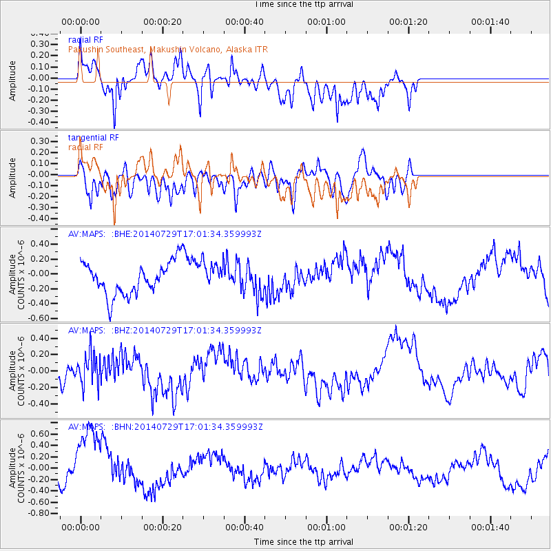
MAPS Pakushin Southeast, Makushin Volcano, Alaska - Earthquake Result Viewer
*The percent match for this event was below the threshold and hence no stack was calculated.
| Earthquake location: |
South Of Fiji Islands |
| Earthquake latitude/longitude: |
-23.6/-176.5 |
| Earthquake time(UTC): |
2014/07/29 (210) 16:50:13 GMT |
| Earthquake Depth: |
35 km |
| Earthquake Magnitude: |
5.2 MW, 5.2 mb |
| Earthquake Catalog/Contributor: |
ISC/ISC |
|
| Network: |
AV Alaska Volcano Observatory |
| Station: |
MAPS Pakushin Southeast, Makushin Volcano, Alaska |
| Lat/Lon: |
53.81 N/166.94 W |
| Elevation: |
333 m |
|
| Distance: |
77.5 deg |
| Az: |
5.788 deg |
| Baz: |
188.977 deg |
| Ray Param: |
$rayparam |
*The percent match for this event was below the threshold and hence was not used in the summary stack. |
|
| Radial Match: |
69.12811 % |
| Radial Bump: |
400 |
| Transverse Match: |
32.65144 % |
| Transverse Bump: |
400 |
| SOD ConfigId: |
3390531 |
| Insert Time: |
2019-04-13 02:17:14.457 +0000 |
| GWidth: |
2.5 |
| Max Bumps: |
400 |
| Tol: |
0.001 |
|
Signal To Noise
| Channel | StoN | STA | LTA |
| AV:MAPS: :BHZ:20140729T17:01:34.359993Z | 0.7849908 | 1.952765E-7 | 2.4876277E-7 |
| AV:MAPS: :BHN:20140729T17:01:34.359993Z | 4.228631 | 7.059293E-7 | 1.6694041E-7 |
| AV:MAPS: :BHE:20140729T17:01:34.359993Z | 0.8600098 | 1.8604372E-7 | 2.1632746E-7 |
| Arrivals |
| Ps | |
| PpPs | |
| PsPs/PpSs | |


