You are here: Home > Network List > PS - Pacific21 Stations List
> Station PSI Parapat, Indonesia > Earthquake Result Viewer
PSI Parapat, Indonesia - Earthquake Result Viewer

| Earthquake location: |
Kuril Islands |
| Earthquake latitude/longitude: |
44.6/149.4 |
| Earthquake time(UTC): |
1995/12/03 (337) 18:01:08 GMT |
| Earthquake Depth: |
33 km |
| Earthquake Magnitude: |
6.6 MB, 8.0 MS |
| Earthquake Catalog/Contributor: |
WHDF/NEIC |
|
| Network: |
PS Pacific21 |
| Station: |
PSI Parapat, Indonesia |
| Lat/Lon: |
2.69 N/98.92 E |
| Elevation: |
987 m |
|
| Distance: |
60.8 deg |
| Az: |
241.89 deg |
| Baz: |
39.135 deg |
| Ray Param: |
0.061211042 |
| Estimated Moho Depth: |
24.5 km |
| Estimated Crust Vp/Vs: |
1.75 |
| Assumed Crust Vp: |
6.468 km/s |
| Estimated Crust Vs: |
3.685 km/s |
| Estimated Crust Poisson's Ratio: |
0.26 |
|
| Radial Match: |
93.85357 % |
| Radial Bump: |
400 |
| Transverse Match: |
85.63203 % |
| Transverse Bump: |
400 |
| SOD ConfigId: |
6273 |
| Insert Time: |
2010-02-27 03:23:12.227 +0000 |
| GWidth: |
2.5 |
| Max Bumps: |
400 |
| Tol: |
0.001 |
|
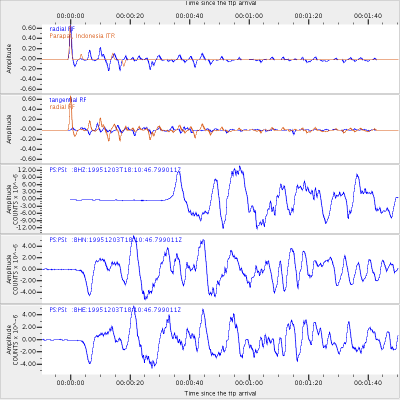
Signal To Noise
| Channel | StoN | STA | LTA |
| PS:PSI: :BHN:19951203T18:10:46.799011Z | 6.1697345 | 3.5232847E-7 | 5.710594E-8 |
| PS:PSI: :BHE:19951203T18:10:46.799011Z | 4.4119315 | 2.2936679E-7 | 5.198784E-8 |
| PS:PSI: :BHZ:19951203T18:10:46.799011Z | 12.231072 | 1.0338983E-6 | 8.453047E-8 |
| Arrivals |
| Ps | 3.0 SECOND |
| PpPs | 10.0 SECOND |
| PsPs/PpSs | 13 SECOND |


