You are here: Home > Network List > IU - Global Seismograph Network (GSN - IRIS/USGS) Stations List
> Station PMG Port Moresby, New Guinea > Earthquake Result Viewer
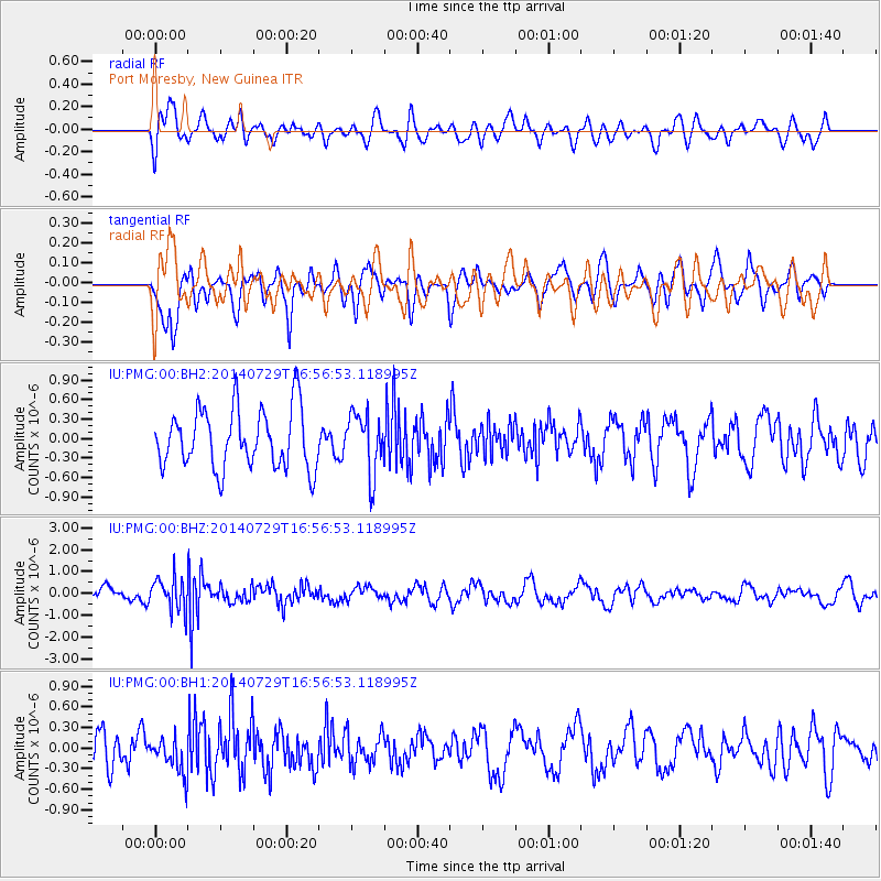
PMG Port Moresby, New Guinea - Earthquake Result Viewer
*The percent match for this event was below the threshold and hence no stack was calculated.
| Earthquake location: |
South Of Fiji Islands |
| Earthquake latitude/longitude: |
-23.6/-176.5 |
| Earthquake time(UTC): |
2014/07/29 (210) 16:50:13 GMT |
| Earthquake Depth: |
35 km |
| Earthquake Magnitude: |
5.2 MW, 5.2 mb |
| Earthquake Catalog/Contributor: |
ISC/ISC |
|
| Network: |
IU Global Seismograph Network (GSN - IRIS/USGS) |
| Station: |
PMG Port Moresby, New Guinea |
| Lat/Lon: |
9.40 S/147.16 E |
| Elevation: |
90 m |
|
| Distance: |
37.5 deg |
| Az: |
285.929 deg |
| Baz: |
116.586 deg |
| Ray Param: |
$rayparam |
*The percent match for this event was below the threshold and hence was not used in the summary stack. |
|
| Radial Match: |
61.880753 % |
| Radial Bump: |
400 |
| Transverse Match: |
63.395485 % |
| Transverse Bump: |
400 |
| SOD ConfigId: |
3390531 |
| Insert Time: |
2019-04-13 02:18:53.686 +0000 |
| GWidth: |
2.5 |
| Max Bumps: |
400 |
| Tol: |
0.001 |
|
Signal To Noise
| Channel | StoN | STA | LTA |
| IU:PMG:00:BHZ:20140729T16:56:53.118995Z | 2.309511 | 7.656372E-7 | 3.3151485E-7 |
| IU:PMG:00:BH1:20140729T16:56:53.118995Z | 0.9586703 | 2.618398E-7 | 2.731281E-7 |
| IU:PMG:00:BH2:20140729T16:56:53.118995Z | 1.0063717 | 4.6258774E-7 | 4.596589E-7 |
| Arrivals |
| Ps | |
| PpPs | |
| PsPs/PpSs | |


