
PSI Parapat, Indonesia - Earthquake Result Viewer
| ||||||||||||||||||
| ||||||||||||||||||
| ||||||||||||||||||
|
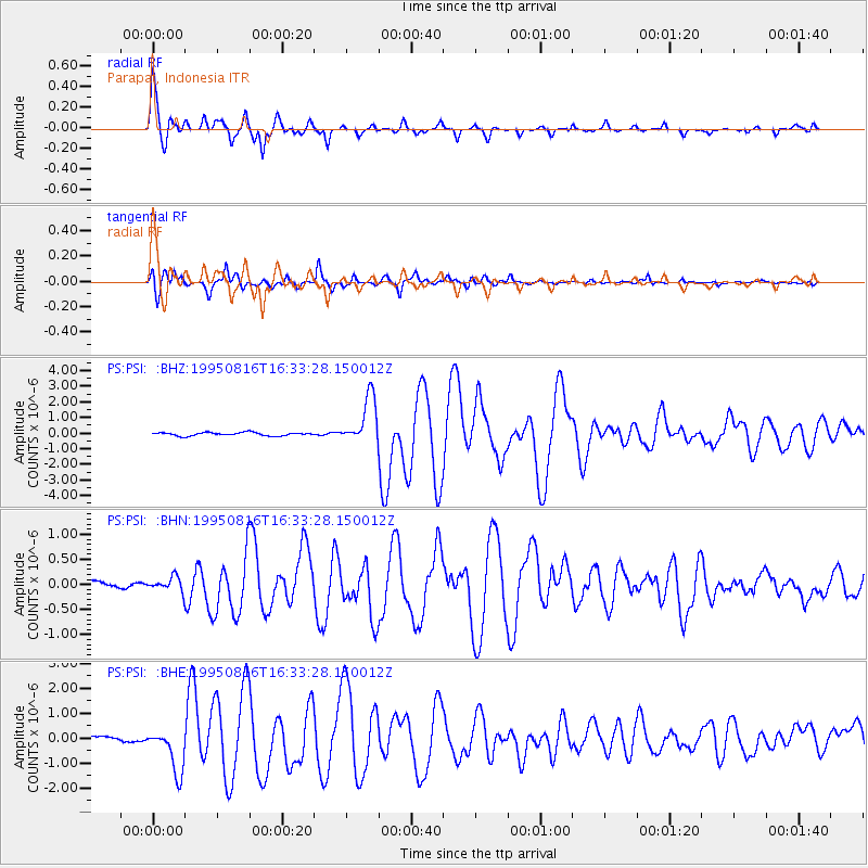
Signal To Noise
| Channel | StoN | STA | LTA |
| PS:PSI: :BHN:19950816T16:33:28.150012Z | 1.2027348 | 1.4475974E-7 | 1.203588E-7 |
| PS:PSI: :BHE:19950816T16:33:28.150012Z | 9.900377 | 8.804547E-7 | 8.893142E-8 |
| PS:PSI: :BHZ:19950816T16:33:28.150012Z | 14.505809 | 1.5223665E-6 | 1.04948754E-7 |
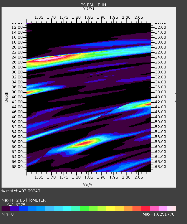
| Arrivals | |
| Ps | 2.7 SECOND |
| PpPs | 9.6 SECOND |
| PsPs/PpSs | 12 SECOND |

