You are here: Home > Network List > TA - USArray Transportable Network (new EarthScope stations) Stations List
> Station G03D McMinnville, OR, USA > Earthquake Result Viewer
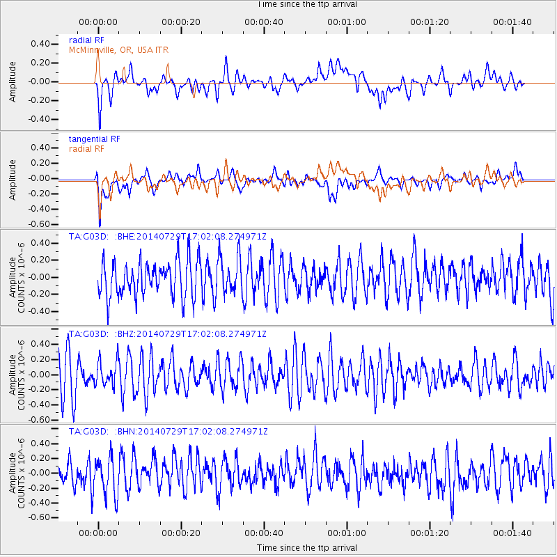
G03D McMinnville, OR, USA - Earthquake Result Viewer
*The percent match for this event was below the threshold and hence no stack was calculated.
| Earthquake location: |
South Of Fiji Islands |
| Earthquake latitude/longitude: |
-23.6/-176.5 |
| Earthquake time(UTC): |
2014/07/29 (210) 16:50:13 GMT |
| Earthquake Depth: |
35 km |
| Earthquake Magnitude: |
5.2 MW, 5.2 mb |
| Earthquake Catalog/Contributor: |
ISC/ISC |
|
| Network: |
TA USArray Transportable Network (new EarthScope stations) |
| Station: |
G03D McMinnville, OR, USA |
| Lat/Lon: |
45.21 N/123.26 W |
| Elevation: |
222 m |
|
| Distance: |
83.8 deg |
| Az: |
34.718 deg |
| Baz: |
227.676 deg |
| Ray Param: |
$rayparam |
*The percent match for this event was below the threshold and hence was not used in the summary stack. |
|
| Radial Match: |
53.415947 % |
| Radial Bump: |
400 |
| Transverse Match: |
57.571926 % |
| Transverse Bump: |
400 |
| SOD ConfigId: |
3390531 |
| Insert Time: |
2019-04-13 02:20:05.501 +0000 |
| GWidth: |
2.5 |
| Max Bumps: |
400 |
| Tol: |
0.001 |
|
Signal To Noise
| Channel | StoN | STA | LTA |
| TA:G03D: :BHZ:20140729T17:02:08.274971Z | 0.70332485 | 1.6489297E-7 | 2.3444781E-7 |
| TA:G03D: :BHN:20140729T17:02:08.274971Z | 1.3887739 | 2.6090945E-7 | 1.8787034E-7 |
| TA:G03D: :BHE:20140729T17:02:08.274971Z | 1.0705998 | 2.2037173E-7 | 2.058395E-7 |
| Arrivals |
| Ps | |
| PpPs | |
| PsPs/PpSs | |


