
PSI Parapat, Indonesia - Earthquake Result Viewer
| ||||||||||||||||||
| ||||||||||||||||||
| ||||||||||||||||||
|
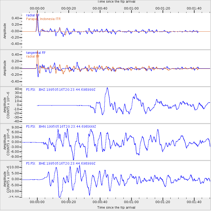
Signal To Noise
| Channel | StoN | STA | LTA |
| PS:PSI: :BHN:19950516T20:23:44.698999Z | 7.265014 | 3.089219E-7 | 4.2521858E-8 |
| PS:PSI: :BHE:19950516T20:23:44.698999Z | 19.916563 | 5.7637004E-7 | 2.8939233E-8 |
| PS:PSI: :BHZ:19950516T20:23:44.698999Z | 47.085716 | 1.7971731E-6 | 3.8168118E-8 |
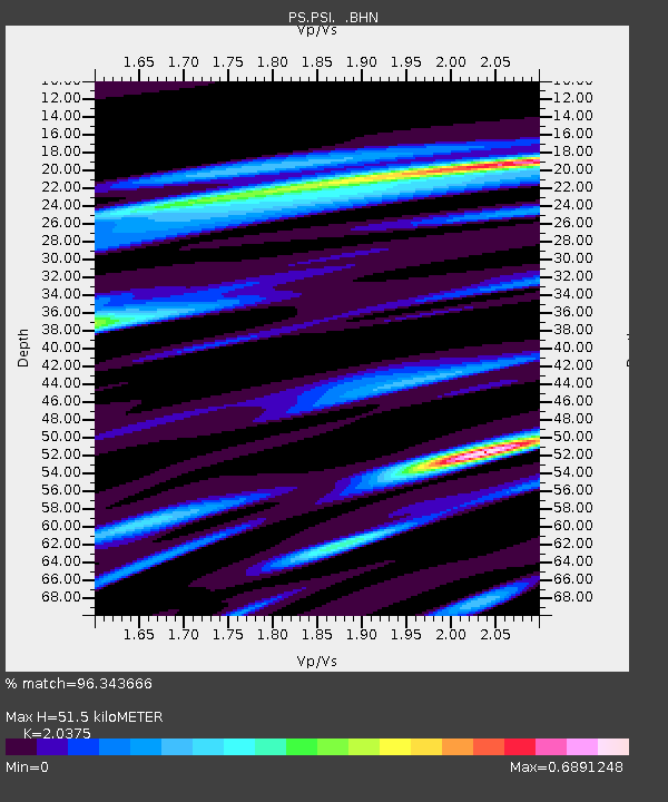
| Arrivals | |
| Ps | 8.5 SECOND |
| PpPs | 23 SECOND |
| PsPs/PpSs | 32 SECOND |

