
PSI Parapat, Indonesia - Earthquake Result Viewer
| ||||||||||||||||||
| ||||||||||||||||||
| ||||||||||||||||||
|
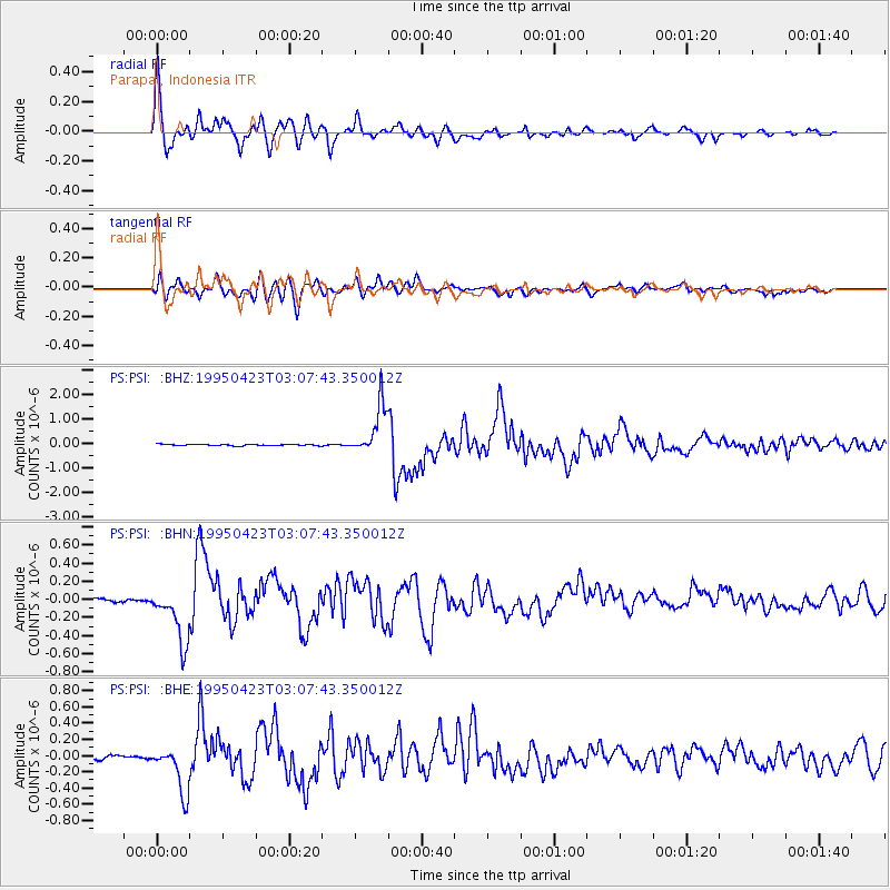
Signal To Noise
| Channel | StoN | STA | LTA |
| PS:PSI: :BHN:19950423T03:07:43.350012Z | 11.433503 | 3.0705314E-7 | 2.685556E-8 |
| PS:PSI: :BHE:19950423T03:07:43.350012Z | 10.528059 | 2.9918473E-7 | 2.8417844E-8 |
| PS:PSI: :BHZ:19950423T03:07:43.350012Z | 34.254356 | 1.0163711E-6 | 2.9671297E-8 |
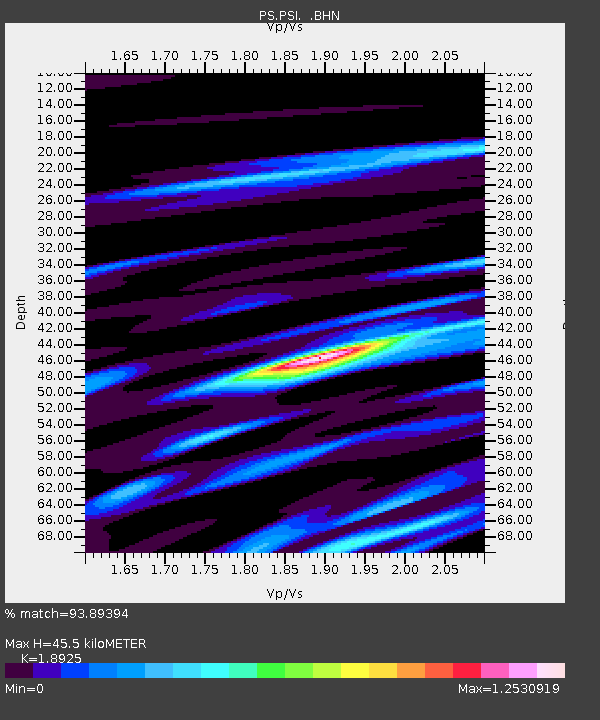
| Arrivals | |
| Ps | 6.4 SECOND |
| PpPs | 20 SECOND |
| PsPs/PpSs | 26 SECOND |

