You are here: Home > Network List > TA - USArray Transportable Network (new EarthScope stations) Stations List
> Station 256A Glennville, GA, USA > Earthquake Result Viewer
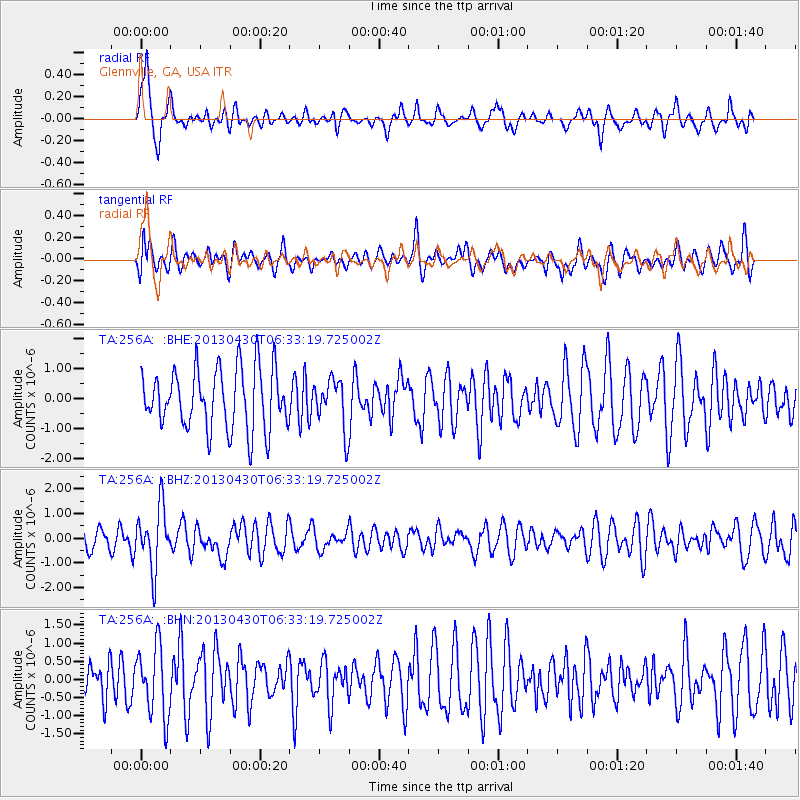
256A Glennville, GA, USA - Earthquake Result Viewer
*The percent match for this event was below the threshold and hence no stack was calculated.
| Earthquake location: |
Azores Islands Region |
| Earthquake latitude/longitude: |
37.6/-24.9 |
| Earthquake time(UTC): |
2013/04/30 (120) 06:25:23 GMT |
| Earthquake Depth: |
10 km |
| Earthquake Magnitude: |
5.8 MW, 5.9 MW, 5.9 MB |
| Earthquake Catalog/Contributor: |
NEIC PDE/NEIC PDE-W |
|
| Network: |
TA USArray Transportable Network (new EarthScope stations) |
| Station: |
256A Glennville, GA, USA |
| Lat/Lon: |
31.98 N/81.89 W |
| Elevation: |
46 m |
|
| Distance: |
46.5 deg |
| Az: |
280.909 deg |
| Baz: |
66.611 deg |
| Ray Param: |
$rayparam |
*The percent match for this event was below the threshold and hence was not used in the summary stack. |
|
| Radial Match: |
72.48357 % |
| Radial Bump: |
400 |
| Transverse Match: |
38.743294 % |
| Transverse Bump: |
400 |
| SOD ConfigId: |
512894 |
| Insert Time: |
2013-09-13 20:56:43.253 +0000 |
| GWidth: |
2.5 |
| Max Bumps: |
400 |
| Tol: |
0.001 |
|
Signal To Noise
| Channel | StoN | STA | LTA |
| TA:256A: :BHZ:20130430T06:33:19.725002Z | 2.3700693 | 1.2549903E-6 | 5.295163E-7 |
| TA:256A: :BHN:20130430T06:33:19.725002Z | 1.6236764 | 9.693231E-7 | 5.969927E-7 |
| TA:256A: :BHE:20130430T06:33:19.725002Z | 0.81654096 | 8.3024224E-7 | 1.0167796E-6 |
| Arrivals |
| Ps | |
| PpPs | |
| PsPs/PpSs | |


