You are here: Home > Network List > TA - USArray Transportable Network (new EarthScope stations) Stations List
> Station 353A Camilla, GA, USA > Earthquake Result Viewer
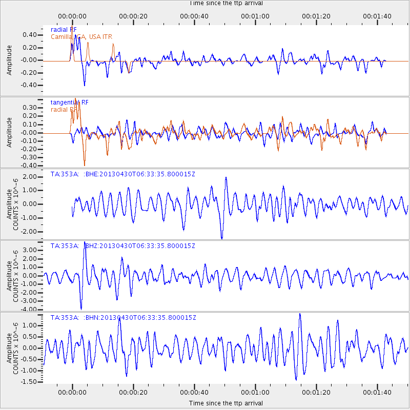
353A Camilla, GA, USA - Earthquake Result Viewer
*The percent match for this event was below the threshold and hence no stack was calculated.
| Earthquake location: |
Azores Islands Region |
| Earthquake latitude/longitude: |
37.6/-24.9 |
| Earthquake time(UTC): |
2013/04/30 (120) 06:25:23 GMT |
| Earthquake Depth: |
10 km |
| Earthquake Magnitude: |
5.8 MW, 5.9 MW, 5.9 MB |
| Earthquake Catalog/Contributor: |
NEIC PDE/NEIC PDE-W |
|
| Network: |
TA USArray Transportable Network (new EarthScope stations) |
| Station: |
353A Camilla, GA, USA |
| Lat/Lon: |
31.35 N/84.22 W |
| Elevation: |
54 m |
|
| Distance: |
48.6 deg |
| Az: |
281.218 deg |
| Baz: |
65.603 deg |
| Ray Param: |
$rayparam |
*The percent match for this event was below the threshold and hence was not used in the summary stack. |
|
| Radial Match: |
57.745865 % |
| Radial Bump: |
400 |
| Transverse Match: |
66.845055 % |
| Transverse Bump: |
400 |
| SOD ConfigId: |
512894 |
| Insert Time: |
2013-09-13 20:57:00.748 +0000 |
| GWidth: |
2.5 |
| Max Bumps: |
400 |
| Tol: |
0.001 |
|
Signal To Noise
| Channel | StoN | STA | LTA |
| TA:353A: :BHZ:20130430T06:33:35.800015Z | 5.719505 | 1.8155725E-6 | 3.1743528E-7 |
| TA:353A: :BHN:20130430T06:33:35.800015Z | 1.3425114 | 4.853773E-7 | 3.615443E-7 |
| TA:353A: :BHE:20130430T06:33:35.800015Z | 0.97016424 | 5.754471E-7 | 5.9314397E-7 |
| Arrivals |
| Ps | |
| PpPs | |
| PsPs/PpSs | |


