
PSI Parapat, Indonesia - Earthquake Result Viewer
| ||||||||||||||||||
| ||||||||||||||||||
| ||||||||||||||||||
|
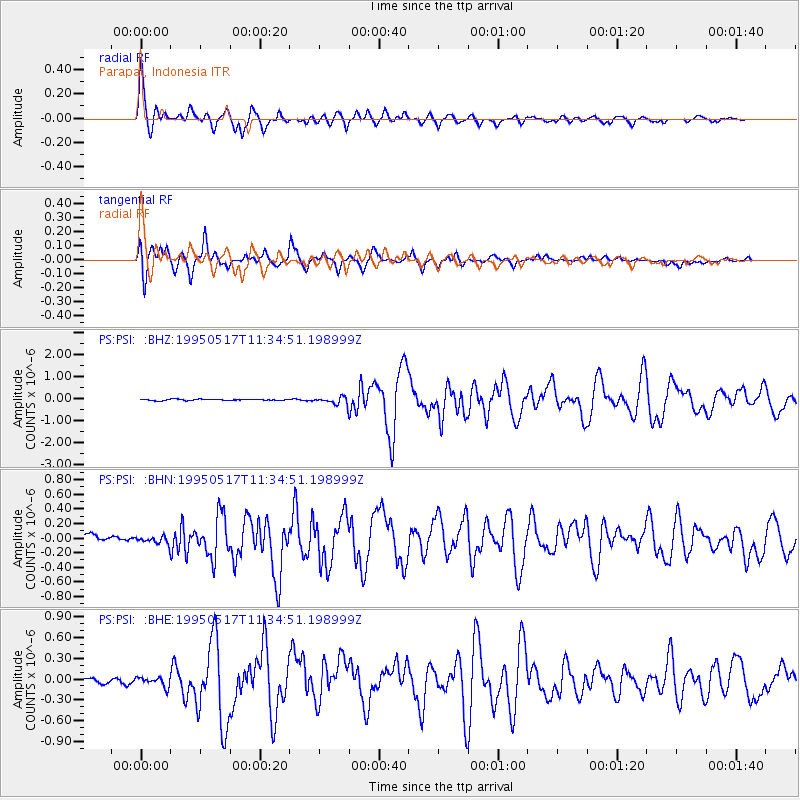
Signal To Noise
| Channel | StoN | STA | LTA |
| PS:PSI: :BHN:19950517T11:34:51.198999Z | 1.9067554 | 5.842804E-8 | 3.064265E-8 |
| PS:PSI: :BHE:19950517T11:34:51.198999Z | 1.9042062 | 7.09936E-8 | 3.728252E-8 |
| PS:PSI: :BHZ:19950517T11:34:51.198999Z | 5.7969365 | 1.7248041E-7 | 2.9753716E-8 |
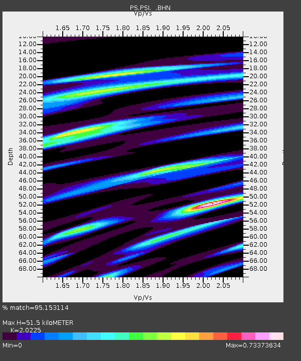
| Arrivals | |
| Ps | 8.4 SECOND |
| PpPs | 23 SECOND |
| PsPs/PpSs | 32 SECOND |

