
PSI Parapat, Indonesia - Earthquake Result Viewer
| ||||||||||||||||||
| ||||||||||||||||||
| ||||||||||||||||||
|
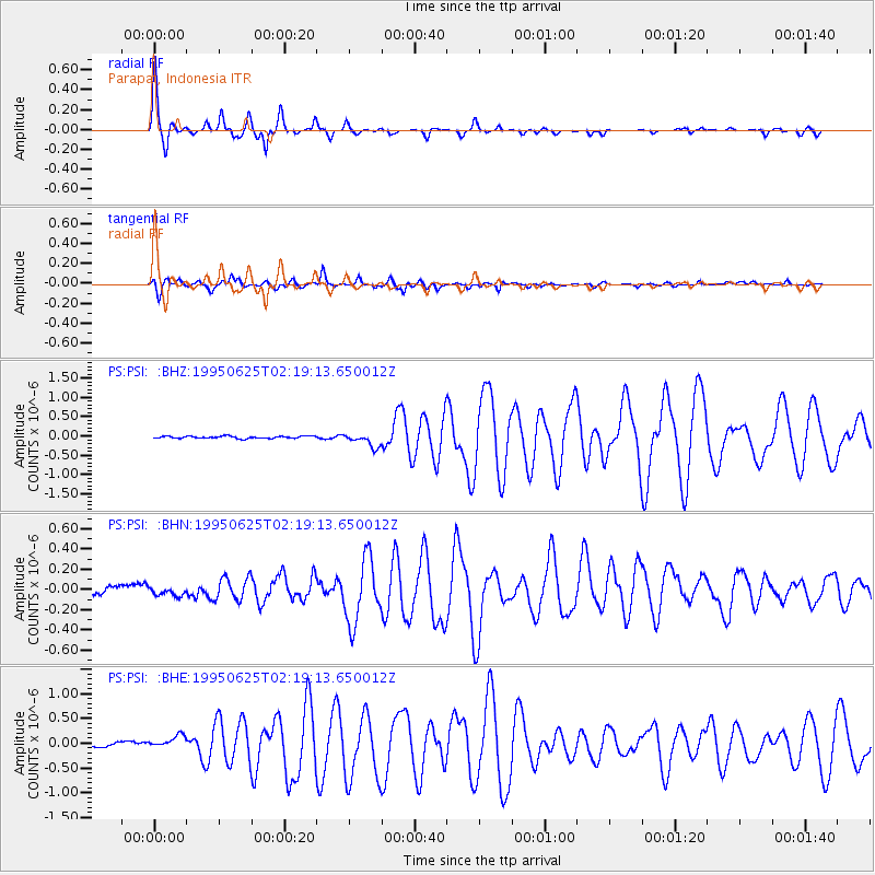
Signal To Noise
| Channel | StoN | STA | LTA |
| PS:PSI: :BHN:19950625T02:19:13.650012Z | 0.822567 | 4.813747E-8 | 5.852103E-8 |
| PS:PSI: :BHE:19950625T02:19:13.650012Z | 2.91227 | 1.3991027E-7 | 4.804165E-8 |
| PS:PSI: :BHZ:19950625T02:19:13.650012Z | 6.264158 | 1.774534E-7 | 2.8328373E-8 |
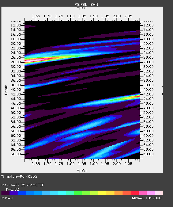
| Arrivals | |
| Ps | 2.8 SECOND |
| PpPs | 10 SECOND |
| PsPs/PpSs | 13 SECOND |

