
PSI Parapat, Indonesia - Earthquake Result Viewer
| ||||||||||||||||||
| ||||||||||||||||||
| ||||||||||||||||||
|
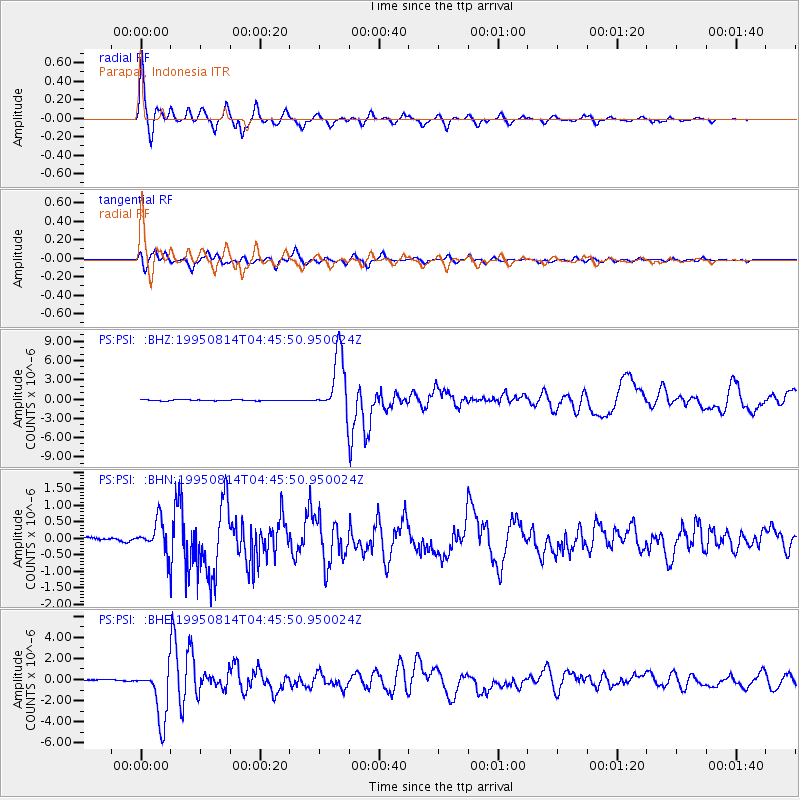
Signal To Noise
| Channel | StoN | STA | LTA |
| PS:PSI: :BHN:19950814T04:45:50.950024Z | 7.667679 | 4.6841367E-7 | 6.1089374E-8 |
| PS:PSI: :BHE:19950814T04:45:50.950024Z | 46.89225 | 2.5666352E-6 | 5.473474E-8 |
| PS:PSI: :BHZ:19950814T04:45:50.950024Z | 62.36922 | 4.6417963E-6 | 7.442447E-8 |
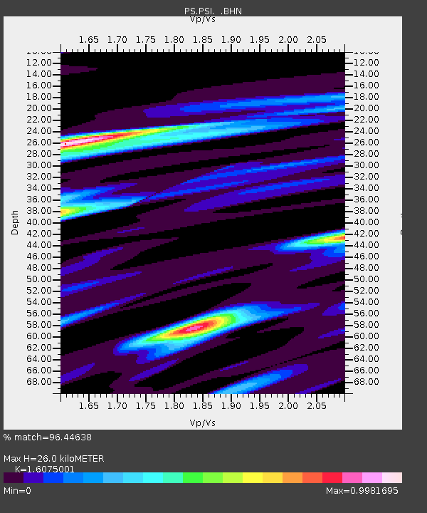
| Arrivals | |
| Ps | 2.6 SECOND |
| PpPs | 9.9 SECOND |
| PsPs/PpSs | 12 SECOND |

