You are here: Home > Network List > TA - USArray Transportable Network (new EarthScope stations) Stations List
> Station L04D Klamath Falls, OR, USA > Earthquake Result Viewer
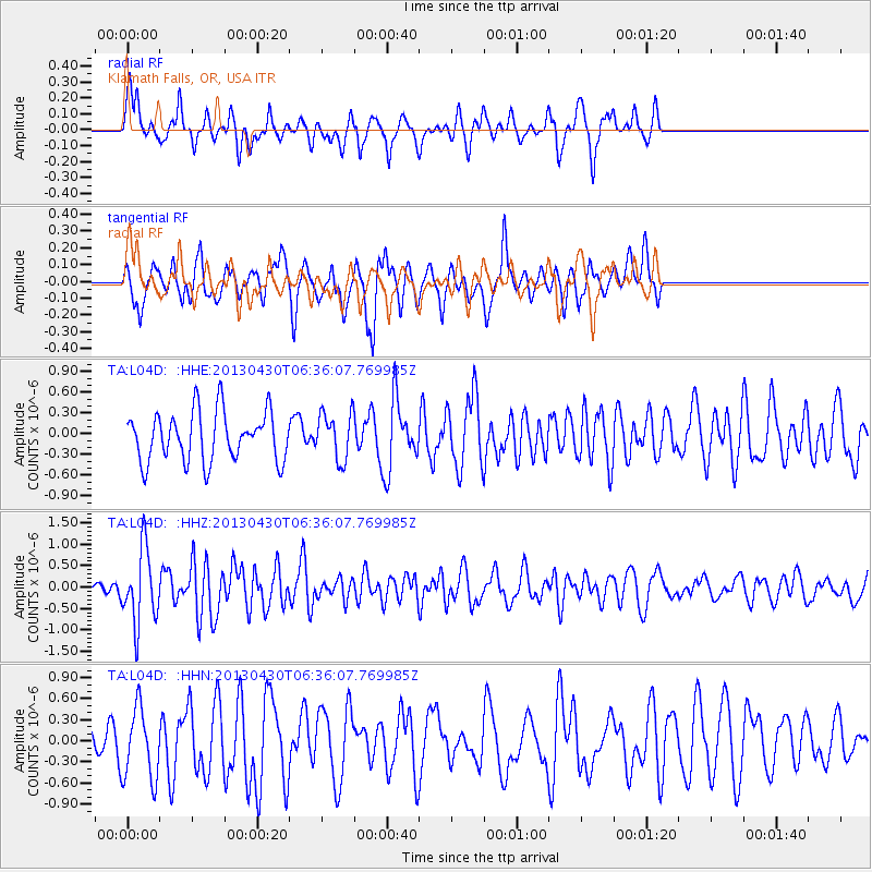
L04D Klamath Falls, OR, USA - Earthquake Result Viewer
*The percent match for this event was below the threshold and hence no stack was calculated.
| Earthquake location: |
Azores Islands Region |
| Earthquake latitude/longitude: |
37.6/-24.9 |
| Earthquake time(UTC): |
2013/04/30 (120) 06:25:23 GMT |
| Earthquake Depth: |
10 km |
| Earthquake Magnitude: |
5.8 MW, 5.9 MW, 5.9 MB |
| Earthquake Catalog/Contributor: |
NEIC PDE/NEIC PDE-W |
|
| Network: |
TA USArray Transportable Network (new EarthScope stations) |
| Station: |
L04D Klamath Falls, OR, USA |
| Lat/Lon: |
42.22 N/122.30 W |
| Elevation: |
1437 m |
|
| Distance: |
70.7 deg |
| Az: |
308.684 deg |
| Baz: |
56.588 deg |
| Ray Param: |
$rayparam |
*The percent match for this event was below the threshold and hence was not used in the summary stack. |
|
| Radial Match: |
67.06043 % |
| Radial Bump: |
400 |
| Transverse Match: |
70.68535 % |
| Transverse Bump: |
400 |
| SOD ConfigId: |
512894 |
| Insert Time: |
2013-09-13 21:05:28.170 +0000 |
| GWidth: |
2.5 |
| Max Bumps: |
400 |
| Tol: |
0.001 |
|
Signal To Noise
| Channel | StoN | STA | LTA |
| TA:L04D: :HHZ:20130430T06:36:07.769985Z | 3.2022269 | 8.6044275E-7 | 2.6870137E-7 |
| TA:L04D: :HHN:20130430T06:36:07.769985Z | 1.6080627 | 5.175241E-7 | 3.2183078E-7 |
| TA:L04D: :HHE:20130430T06:36:07.769985Z | 0.9335784 | 3.345502E-7 | 3.5835257E-7 |
| Arrivals |
| Ps | |
| PpPs | |
| PsPs/PpSs | |


