You are here: Home > Network List > TA - USArray Transportable Network (new EarthScope stations) Stations List
> Station P54A Burton, WV, USA > Earthquake Result Viewer
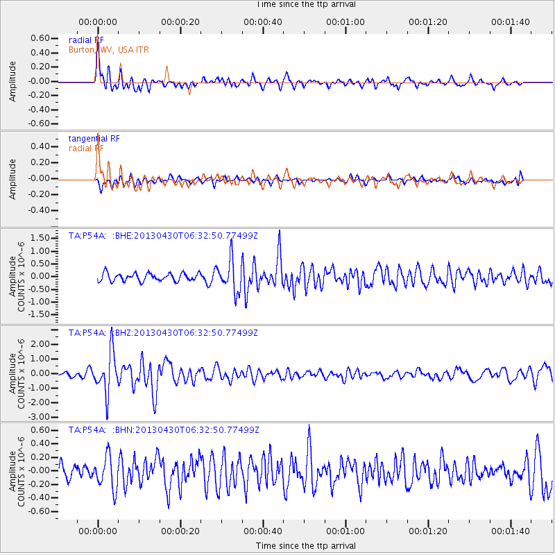
P54A Burton, WV, USA - Earthquake Result Viewer
*The percent match for this event was below the threshold and hence no stack was calculated.
| Earthquake location: |
Azores Islands Region |
| Earthquake latitude/longitude: |
37.6/-24.9 |
| Earthquake time(UTC): |
2013/04/30 (120) 06:25:23 GMT |
| Earthquake Depth: |
10 km |
| Earthquake Magnitude: |
5.8 MW, 5.9 MW, 5.9 MB |
| Earthquake Catalog/Contributor: |
NEIC PDE/NEIC PDE-W |
|
| Network: |
TA USArray Transportable Network (new EarthScope stations) |
| Station: |
P54A Burton, WV, USA |
| Lat/Lon: |
39.61 N/80.48 W |
| Elevation: |
473 m |
|
| Distance: |
42.9 deg |
| Az: |
290.567 deg |
| Baz: |
74.309 deg |
| Ray Param: |
$rayparam |
*The percent match for this event was below the threshold and hence was not used in the summary stack. |
|
| Radial Match: |
79.43625 % |
| Radial Bump: |
400 |
| Transverse Match: |
70.16594 % |
| Transverse Bump: |
400 |
| SOD ConfigId: |
512894 |
| Insert Time: |
2013-09-13 21:09:54.470 +0000 |
| GWidth: |
2.5 |
| Max Bumps: |
400 |
| Tol: |
0.001 |
|
Signal To Noise
| Channel | StoN | STA | LTA |
| TA:P54A: :BHZ:20130430T06:32:50.77499Z | 6.1555166 | 1.4370058E-6 | 2.3345008E-7 |
| TA:P54A: :BHN:20130430T06:32:50.77499Z | 2.0516818 | 2.477172E-7 | 1.207386E-7 |
| TA:P54A: :BHE:20130430T06:32:50.77499Z | 4.185437 | 6.3584105E-7 | 1.5191748E-7 |
| Arrivals |
| Ps | |
| PpPs | |
| PsPs/PpSs | |


